World-class training for the modern energy industry

An Introduction to Offshore Seismic Data Acquisition (G041)

Tutor(s)

Malcolm Lansley: Consultant Geophysicist.

Overview

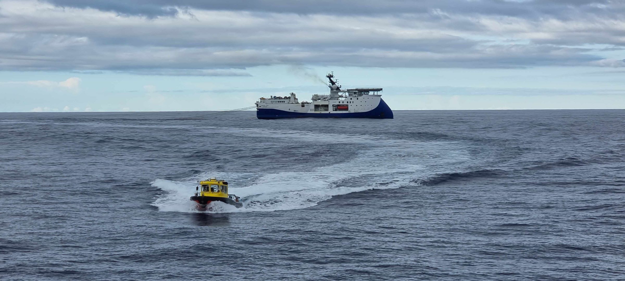
Participants will learn the steps necessary to plan successful offshore seismic acquisition projects and will also learn how to work with contractors to ensure that projects are executed safely and according to plan.

Duration and Logistics

Classroom version: A 1-day classroom course comprising a mix of lectures (90%) and exercises (10%). An optional workshop where a client’s project data may be reviewed can be added. The manual will be provided in digital format and participants will be required to bring a laptop or tablet computer to follow the lectures and exercises. Multiple choice quizzes will be utilized to reinforce learnings.

Virtual version: Two 4-hour interactive online sessions presented over 2 days. A digital manual and exercise materials will be distributed to participants before the course. Some reading and several exercises are to be completed by participants off-line. Multiple choice quizzes will be utilized to reinforce learnings.

Level and Audience

Fundamental. Intended for early career geoscientists and technical support staff who routinely work with seismic data and who would like to manage seismic acquisition projects and interact effectively with data acquisition professionals.

Objectives

You will learn to:

  1. Revisit the fundamental principles of seismic wave propagation.
  2. Review seismic vessel and equipment options for data acquisition and logistics in different marine environments.
  3. Understand key project parameters required to design a successful project.
  4. Review the bid tender process and be able to recommend contract specifications.
  5. Outline a management plan for Health, Safety and Environmental compliance.
  6. Appreciate the importance of employing qualified field QC personnel to ensure the successful completion of data acquisition projects.
An Introduction to Onshore Seismic Data Acquisition (G040)

Tutor(s)

Malcolm Lansley: Consultant Geophysicist.

Overview

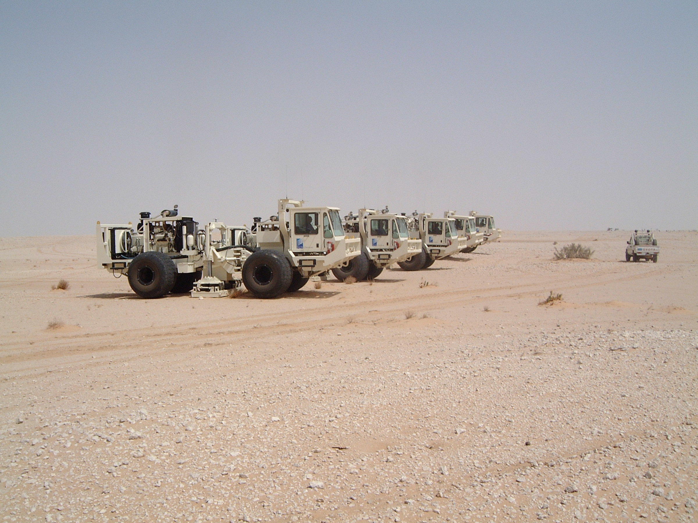
Participants will learn the steps necessary to plan successful onshore seismic acquisition projects and will also learn how to work with contractors to ensure that projects are executed safely and according to plan.

Duration and Logistics

Classroom version: A 1-day classroom course comprising a mix of lectures (90%) and exercises (10%). An optional workshop where a client’s project data may be reviewed can be added. The manual will be provided in digital format and participants will be required to bring a laptop or tablet computer to follow the lectures and exercises. Multiple choice quizzes will be utilized to reinforce learnings.

Virtual version: Two 4-hour interactive online sessions presented over 2 days. A digital manual and exercise materials will be distributed to participants before the course. Some reading and several exercises are to be completed by participants off-line. Multiple choice quizzes will be utilized to reinforce learnings.

Level and Audience

Fundamental. Intended for early career geoscientists and technical support staff who routinely work with seismic data and who desire to manage seismic acquisition projects and interact effectively with data acquisition professionals.

Objectives

You will learn to:

  1. Revisit the fundamental principles of seismic wave propagation.
  2. Review equipment options for data acquisition and logistics.
  3. Understand key project parameters required to design a successful project.
  4. Review the bid tender process and recommend contract specifications.
  5. Outline a management plan for Health, Safety and Environmental compliance.
  6. Appreciate the importance of employing qualified field QC personnel to ensure the successful completion of data acquisition projects.
Characterization of Clastic Reservoirs: Workflows for Reservoir Evaluation (G035)

Tutor(s)

Rene Jonk: Director, ACT-Geo Consulting and Training; Honorary Professor, University of Aberdeen.

Overview

Reservoir mapping at production scale has to be performed with an understanding of clastic depositional systems, with full integration of core, core-plugs, well logs, seismic and production and engineering data. The variation in reservoir architecture of most common deposition-system morphotypes strongly influences development and production strategies, as well as in mapping techniques for not only the field scale but also to increase chances of finding near-field opportunities. The workshop examines common reservoir facies in transitional-marine to deep water systems, from fluvio-, wave- and tidal-dominated deltas, incised valleys, deep water channel systems and distributary channel lobe systems (deep water fans). Discussions include dimensional data of sand bodies in the different environments and recognition criteria in cores, well logs and seismic. The class will present optimized workflows for reservoir mapping, including the definition of the deliverables that need to be achieved in different business stages, focusing on when, why and how to develop them.

Duration and Logistics

Classroom version: 3 days; a mix of lectures (55%), core observation (10%) and hands-on exercises (35%). The manual will be provided in digital format and participants will be required to bring a laptop or tablet computer to follow the lectures and exercises.

Virtual version: Five 4-hour interactive online sessions presented over 5 days. A printed manual and exercise materials will be distributed to participants before the course and several exercises are to be completed by participants off-line.

Level and Audience

Advanced. This course is intended for geologists, geophysicists and petrophysicists with basic training in sequence stratigraphy and basic clastic facies.

Objectives

You will learn to:

  1. Recognize different environments of deposition (EoDs) in cores, emphasizing typical facies stacking in common transitional marine and deep marine reservoirs.
  2. Classify facies and stacking in typical transitional marine to deep marine EoDs.
  3. Mechanisms for sediment transport in different EoDs and impact on reservoir rock properties.
  4. Integrate core and core plug information in reservoir analysis, tying to well log and seismic data.
  5. Recognize typical log patterns in different depositional systems.
  6. Recognize typical seismic map views and cross-sectional views of sand-rich EoDs.
  7. Apply mapping techniques for well logs and seismic with emphasis on identification of EoDs.
  8. Make pre-drill predictions based on understanding of EoDs and seismic response.
  9. Understand dimensional data for sandbodies in different EoDs
  10. Implement reservoir mapping workflows that emphasize data integration and focus on deliverables in different business stages.

Introduction to Clastic Reservoirs: Stratigraphic and Structural Heterogeneities that Impact Performance (G047)

Tutor(s)

Mike Boyles: Retired Shell Oil; Affiliate Faculty, Colorado School of Mines.

Overview

This is a 5-day in-depth introduction to clastic reservoirs, with a focus on stratigraphic and structural heterogeneities that impact reservoir prediction and production. The course will benefit any subsurface team member that is concerned about how variations in the geology might impact reservoir performance. Taking this course will allow one to better interpret subsurface data sets and outcrop exposures, resulting in a better understanding of the impact of stratigraphic and structural heterogeneities on reservoir performance.

It is recommended that you take this class before taking Clastic Reservoirs Field Seminar: Stratigraphic and Structural Heterogeneities That Impact Reservoir Performance, Colorado and Utah (G012) in order to make better outcrop observations and understand the terminology used in field discussions. This will maximize the benefit of time spent in the field for G012 participants.

Duration and Logistics

Classroom version: 5 days; a mix of lectures (75%) and hands-on exercises (25%). The manual will be provided in digital format and participants will be required to bring a laptop or tablet computer to follow the lectures and exercises.

Virtual version: Five 4-hour interactive online sessions presented over 5 days. A digital manual and exercise materials will be distributed to participants before the course. Some reading and several exercises are to be completed by participants off-line.

Level and Audience

Fundamental. It is a background course for subsurface team members to teach geologic basics that are often missed when predicting/understanding reservoirs. These basics can be applied to better predict reservoir performance for estimating reservoir productivity in exploration projects. It also allows for better field development planning and provides understanding of conformance issues within an existing field.

Objectives

You will learn to:

  1. Understand detailed facies analysis within deposits of wave dominated deltas, fluvial dominated deltas, fluvial systems, tidal/estuarine, eolian and turbidites.
  2. Recognize key facies in cores and logs.
  3. Use depositional models to make better reservoir geometry predictions.
  4. Divide subsurface reservoirs into flow units that capture key reservoir flow characteristics and heterogeneities at a variety of reservoir model scales.
  5. Communicate and discuss flow unit properties with subsurface team disciplines.
  6. Use key sequence stratigraphic concepts in a practical and predictive way.

Applied Concepts in Fractured Reservoirs with Discussions on Production, EOR, CO2 Sequestration and Geothermal Energy (G039)

Tutor(s)

John Lorenz: Co-founder and Partner, FractureStudies LLC.

Scott Cooper: Co-founder and Partner, FractureStudies LLC.

Overview

This course explores the wide range of structures that fall under the term ‘fracture’ and examines the effects of different fracture types on permeability in conventional and unconventional hydrocarbon reservoirs, and for EOR, CO2 sequestration and geothermal energy applications. The course establishes an understanding of natural fractures by explaining fracture mechanics and the origins of fractures, and then presents practical approaches to analyzing and working with fractures. Topics will include: collecting fracture data; measuring fracture attributes; differentiating natural from induced fractures; calibrating fracture data (from core, CT scans, outcrops, image logs and seismic); and determining in situ stresses. The course also describes how to predict fracture types in different structural domains and in different types of reservoirs, how the differences between extension and shear fractures control both individual fracture permeability and fracture network interconnectedness, and how to assess the interaction between natural and hydraulic stimulation fractures. Discussions of the applications to CO2 sequestration, geothermal energy, hydrocarbon reservoirs and enhanced recovery are included.

Duration and Logistics

Classroom version: A 3-day classroom course comprising a mix of lectures (80%) and hands-on exercises (20%). The manual will be provided in digital format and participants should bring a laptop or tablet computer to follow the lectures and exercises. A highlight of the classroom version is the inclusion of a hands-on, 65-plus piece teaching collection of natural and induced fractures in core.

Virtual version: Five 4-hour interactive online sessions presented over 5 days. A digital manual and exercise materials will be distributed to participants before the course. Some reading and exercises are to be completed by participants off-line.

Level and Audience

Advanced. Intended for geoscientists, reservoir and completion engineers, and petrophysicists, who wish to characterize and understand fracture systems and their effects on reservoir permeability and fluid flow. The class includes assessing how fracture permeability is affected by the in-situ stress system, and the interaction of natural fractures with hydraulic stimulation fractures.

Objectives

You will learn to:

  1. Appreciate how different fracture types have different effects on reservoir permeability and fluid flow.
  2. Assess how fracture types can vary by lithology within the same structural setting.
  3. Establish how fracture types can vary by structural setting within the same lithology.
  4. Assess fracture permeability and how it can be sensitive to changes in the in-situ stress during production and injection.
  5. Recognize fracture type using the small sampling of a reservoir offered by core and how this can provide a conceptual model for differentiating radial from anisotropic drainage, or flow away from the well during injection.
  6. Appreciate the interaction of natural fractures with hydraulic stimulation fractures as utilized in hydrocarbon, sequestration and geothermal industries, depending on fracture type and orientation relative to the in-situ stresses.
  7. Use insights into fracture mechanics and the origins of fractures, and gain an understanding of natural fractures and their potential effects on fluid flow.

Uncertainty and Risk in Development: Quantifying Subsurface Risk and Uncertainty for Producing Assets (G038)

Tutor(s)

Mark Bentley or Mark Cook: TRACS International Consultancy.

Overview

The quantification of risk and uncertainty is often discussed in the context of exploration and appraisal, yet most of the upstream E&P business concerns decision-making in producing assets. Handling uncertainty in development and production must deal with a growing and often imperfect production database, against a backdrop of constantly changing circumstances. As the life cycle progresses, initial uncertainties over volume and productivity narrow but are supplanted by new uncertainties, such as sweep efficiency, fine scale architecture and changing responses to new production mechanisms and techniques. These new issues demand a change in approach for the quantification of uncertainty, and vigilance is required to avoid the subsurface interpretation simply collapsing to a best guess. This short, focused workshop explores the key aspects required to manage subsurface uncertainties and associated risks during the producing field life, in terms of people, tools and approach. It will close with a set of questions to ask yourself and others, suitable for reference in informal personal or team reviews, peer reviews and peer assists.

Duration and Logistics

Classroom version: A 1-day course comprising a mix of lectures, case studies and exercises. The manual will be provided in digital format and participants will be required to bring a laptop or tablet computer to follow the lectures and exercises.

Virtual version: Two 4-hour interactive online sessions presented over 2 days. A digital manual and exercise materials will be distributed to participants before the course. Some reading and several exercises are to be completed by participants off-line.

Level and Audience

Advanced. Designed for geoscientists, reservoir engineers, petrophysicists, well technologists, team leaders and management involved in the quantification of risk and uncertainty in fields under development or in production. The class will provide an opportunity for learning, inspiration and discussion with other modelers.

Objectives

You will learn to:

  1. Resolve misunderstandings over definitions in risk and uncertainty.
  2. Understand the key differences between uncertainty and risk in development, compared to exploration and appraisal.
  3. Explain and mitigate common errors in handling probability.
  4. Describe workflows for handling risk and uncertainty in development decisions.
  5. Account for the impact of cognitive bias in E&P, and what to do about it.

Reservoir Engineering Fundamentals: The Essentials in a Day (G037)

Tutor(s)

Mark Cook: Associate Reservoir Engineer at TRACS International Consultancy and Independent Engineer at Delta-T Energy Consultancy.

Overview

Have you been on reservoir engineering classes in the past, heard the terms, seen the equations but not used any of it directly yourself? Would you like someone to run over the basics and just pick out the essentials, the parts everyone really needs to know? This short, focused class is designed to explain how reservoir engineers make subsurface interpretations, use these to build models to make forecasts and use these in turn to influence significant investment decisions. The course will cover what types of models the reservoir engineer uses, from simple analytical (graphical and spreadsheet) tools to more complex numerical simulators. It will put in context the key fundamentals of rock and fluid properties, reservoir deliverability, well performance and process design. The course will also illustrate how these fundamentals and the commercial E&P context place constraints on forecasts, and why a significant associated range of uncertainty results. This will be done in plain language accessible to those working outside reservoir engineering with the aim of giving you what you need to know to understand the subject – just the essential details.

Duration and Logistics

Classroom version: A 1-day classroom course comprising a combination of lectures and exercises. The manual will be provided in digital format and participants should bring a laptop or tablet computer to follow the lectures and exercises.

Virtual version: Two 4.5-hour interactive online sessions presented over 2 days. A digital manual and exercise materials will be distributed to participants before the course. Some reading and several exercises are to be completed by participants off-line.

Level and Audience

Fundamental. Designed for those who interface with reservoir engineering professionals and need to understand the language, techniques and assumptions they make in forecasting reservoir performance under various development schemes. The class will provide an opportunity for learning, inspiration and discussion.

Objectives

You will learn to:

  1. Understand the principles of fluid flow in porous media (reservoirs).
  2. Recognize how fluid properties influence reservoir, well and processing performance.
  3. Distinguish the benefits and limitations of well testing.
  4. Understand how engineers decide on reservoir development methods, predict recovery factors and production profiles for oil and gas reservoirs.
  5. Appreciate that not all reservoir models need to be complex and understand when simple models suffice and when complex numerical simulation models are justifiable.
  6. Recognize tools used for reservoir monitoring and standards for reporting reserves.

How to Make a Good Reservoir Model: It’s Not the Software, It’s the Design (G036)

Tutor(s)

Mark Bentley: TRACS International Consultancy and Langdale Geoscience.

Overview

How can you tell the difference between a ‘good’ reservoir model and a ‘bad’ one? This short, focused class is designed to draw out the common reasons for ‘good’ and ‘bad’ outcomes, under the premise that models add value only when they add clear value to business decisions. The theme throughout the event will be the overriding issue of model design and the five areas of common error: model purpose; selection of elements; use of determinism and probability; model scale; and uncertainty handling. Advice will be given on how to review models, what questions to ask the model builders, and how to determine whether the output from models can be relied upon and used to support decisions. The course will close with a set of questions to ask yourself and others, suitable for reference in peer reviews or assists.

Duration and Logistics

Classroom version: A 1-day course comprising a mix of lectures, case studies and exercises. The manual will be provided in digital format and participants will be required to bring a laptop or tablet computer to follow the lectures and exercises.

Virtual version: Two 4-hour interactive online sessions presented over 2 days. A digital manual and exercise materials will be distributed to participants before the course. Some reading and several exercises are to be completed by participants off-line.

Level and Audience

Fundamental. Designed for people who want an update or refresh on working with reservoir models without having to spend a week out of the office. The class will provide an opportunity for learning, inspiration and discussion with other modelers.

Objectives

You will learn to:

  1. Explain the common causative factors for modelling ‘disappointments’.
  2. Define model purpose and explain the use of framing.
  3. Understand the fluid sensitivity to selection of model elements.
  4. Describe techniques for handling small-scale detail in large models.
  5. Be able to select between techniques for quantifying uncertainty.
  6. Implement QC tips to evaluate your (and other people’s) models.

Characterization, Modeling, Simulation and Development Planning in Deepwater Clastic Reservoirs, Tabernas, Spain (G076)

Tutor(s)

Mark Bentley: TRACS International Consultancy and Langdale Geoscience.

Overview

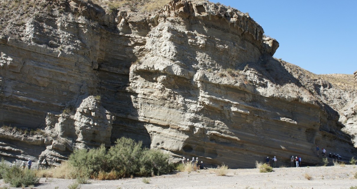
This course is led by a production geologist and reservoir engineer involved in deepwater reservoir development, and is presented as a practical reservoir discussion rather than purely a traditional geological field trip. The objective of this field course is to explore the reservoir modelling and petroleum engineering aspects of deepwater clastic reservoirs. The discussions highlight the linkage from depositional processes to geological architecture and flow heterogeneity in development planning. The Tabernas outcrops are very well exposed and offer examples of sand-rich and debris-flow-dominated reservoirs, high net:gross fan systems and classic mud-dominated facies. In particular, they give excellent insights into the reservoir heterogeneities occurring within apparently continuous ‘sand lobes’ and major channels.

Duration and Logistics

A 7-day field course based in Almeria, Spain, comprising a mix of field activities and exercises. Transport will be by SUV on paved roads and unpaved tracks.

Level and Audience

Advanced. The course is largely aimed at geologists and reservoir engineers working on deepwater developments. The course is best suited to multidisciplinary team of geologists, geophysicists, petrophysicists and reservoir engineers.

Exertion Level

This class requires a MODERATE exertion level. There will be multiple walks of up to 1km (0.5 mile) most days. The longest walk of the class is approximately 2km (1 mile), with an ascent (and descent) of 75m (245 ft). The field area is in Europe’s only desert region and participants should expect high temperatures and an arid working environment. Participants should also be prepared for sudden and heavy rain showers.

Objectives

You will learn to:

  1. Assess the genetic processes that produce slumps, slides, debrites and high/low density turbidites, and explain why the concept of confinement underpins the description of heterogeneity in deepwater clastic systems.
  2. Evaluate the extent to which pay is under-/over-estimated in mud-rich/sand-rich systems, respectively, and the resulting errors in STOIIP and PI estimation.
  3. Organise a detailed sedimentological description into key reservoir elements and build an architectural model using those elements.
  4. Assess the basic principle of flow in porous media (Darcy) and describe how flow heterogeneity varies in layered and amalgamated clastic systems.
  5. Appraise the contrasting heterogeneities in sand- and mud-rich systems and determine how much detail is required in a reservoir description based on a consideration of fluid type and production mechanism.
  6. Evaluate how kv/kh impacts recovery in typical deepwater clastic architectures; optimally locate a well to optimize sweep for a range of architectural cases.
  7. Judge length scale variations for a typical deepwater clastic system, and discuss how this would be handled in a reservoir modelling and simulation context.

The Essentials of Rock Physics and Seismic Amplitude Interpretation (G075)

Tutor(s)

Eleanor Oldham: Senior Geophysicist, Merlin Energy Resources.

Overview

This course introduces participants to the principles, workflows and limitations of interpreting seismic data using rock physics. The principal topics to be covered include how AVO works, what should the interpreter expect, rock physics inputs for seismic models, rock properties from seismic and rock physics in prospect risking.

Duration and Logistics

Classroom version: A 4-day in-person course, comprising a mix of lectures and interactive learning through worked Excel examples. The course manual will be provided in digital format.

Virtual version: Eight 3-hour live online sessions presented over 8 days, comprising a mix of lectures and interactive learning through worked Excel examples. The course manual will be provided in digital format.

Level and Audience

Fundamental. The course is largely aimed at geoscientists, reservoir engineers and petrophysicists wanting an introduction to the subject of rock physics and seismic amplitude interpretation.

Objectives

You will learn to:

  • Construct a simple AVO model and apply it to seismic interpretation in different AVO settings.
  • Illustrate the characteristics of seismic wavelets and approaches to synthetic well ties with reference to models.
  • Demonstrate the use of rock physics for seismic modelling and Gassmann’s equation in fluid substitution.
  • Tackle a variety of rock physics issues, including fluid substitution in shaly and laminated sands, modelling of tight sands and log editing.
  • Differentiate AVO techniques and practical AVO issues, including the potential for interpretation ambiguity and data quality.
  • Apply band limited impedance with respect to net pay prediction and their limitations.
  • Implement the use of Bayesian update to evaluate probability in inversion and risking.