World-class training for the modern energy industry

Understanding Faults, Fault Seal and Fault Rupture: Applications to Fluid Trapping, Pressure Containment and Induced Seismicity, Moab, Utah (G058)

Tutor(s)

Bob Krantz: Consulting Geologist and Adjunct Professor, University of Arizona.

Peter Hennings: Consulting Geologist and Research Scientist and Lecturer, UT Austin, Texas.

Overview

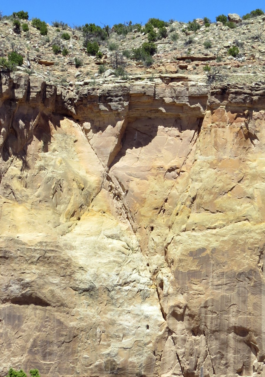
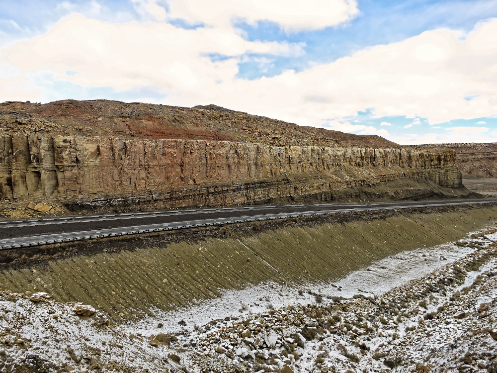
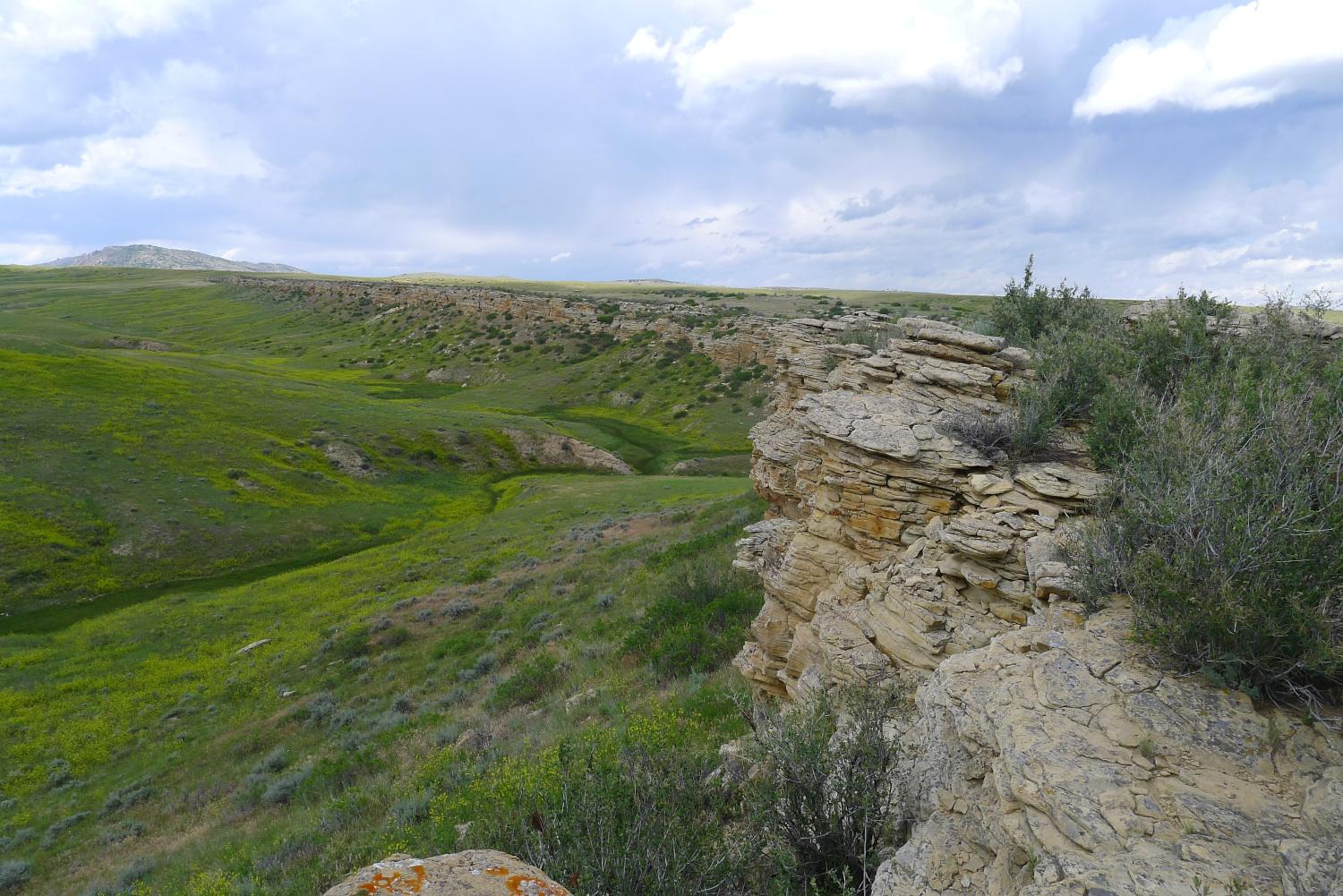
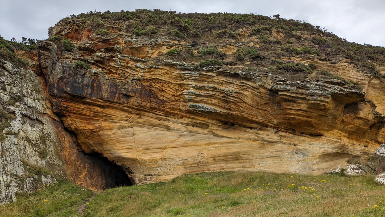
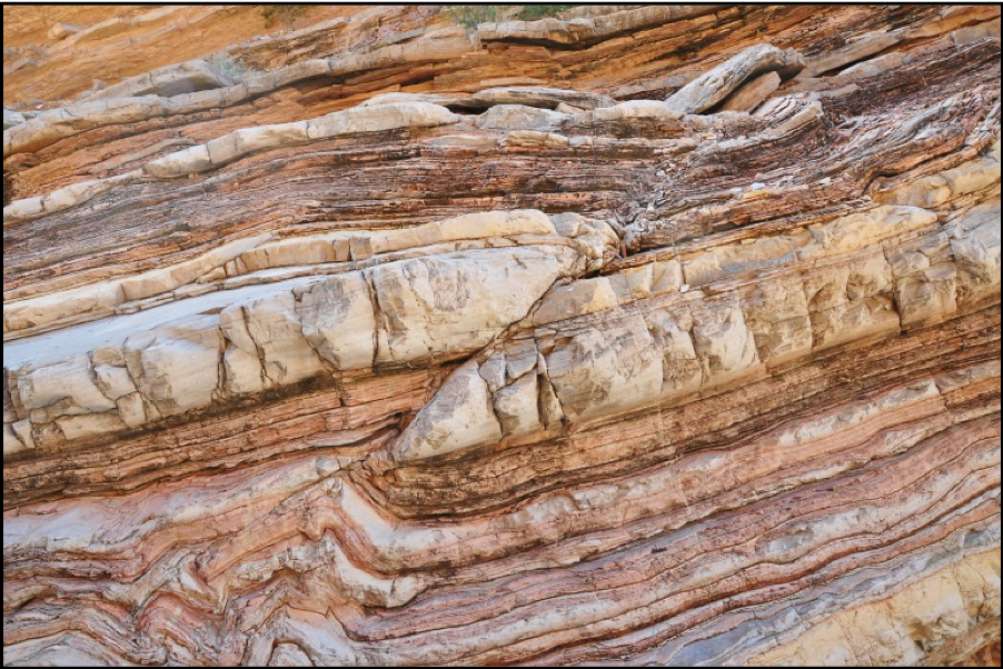
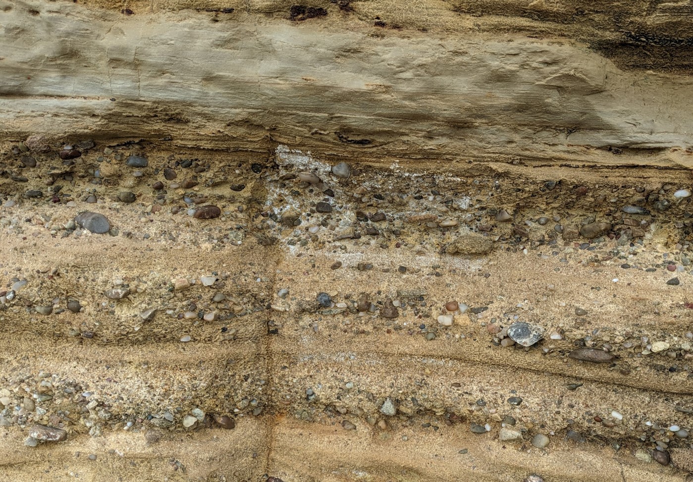
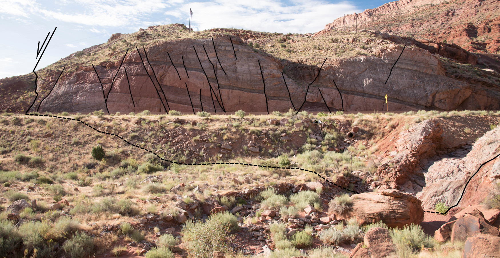
This course provides an analysis-level treatment of fault geometry, characterization of seal effectiveness, and assessment of rupture hazard with application to hydrocarbon exploration, reservoir development and management, fluid pressure containment analysis for CCS, and induced seismicity hazard assessment. The Moab fault system and surrounding geology provide exceptional examples of trap-scale structures with fault zone characteristics that vary depending on offset and juxtaposed rock type, and which are documented to have both sealed and leaked over geologic time in patterns that are clearly expressed. Reframing these outcrops to subsurface application is immensely valuable in understanding static and dynamic fault behavior.

Duration and Logistics

6 days; classroom lectures (30%), practical exercises (30%) and field visits to some of Earth’s best-exposed and thoroughly studied outcropping fault systems (40%).

The course is based in Moab, Utah, with participants arriving in and departing from Grand Junction, Colorado.

Level and Audience

Advanced. This course is intended for geoscientists and reservoir engineers who work with layered faulted reservoirs. Participants would benefit from having a basic familiarity with structural geology.

Exertion Level

This class requires a MODERATE exertion level. The fieldwork will involve walking up and down slopes over rough ground. There will be walks of up to 1.6km (1 mile) on most days, the most strenuous being an ascent (and descent) of 100m (330 ft) over rocky ground as part of a 3.2km (2 miles) walk. The altitude of the field area ranges from 1200–1750m (4000–5800 ft), which may lead to unexpected shortness of breath for some. The weather should be pleasant with typical highs of 27°C (80°F) in the fall, but early morning temperatures may be below 5°C (40°F) and highs could reach 32° (90° F) on some days. Transport will be by mini-van or SUV on paved and graded dirt roads.

Objectives

You will learn to:

  1. Describe fault geometry and how they form, displace and link in 2-D and 3-D.
  2. Understand how fault systems evolve over geologic time.
  3. Characterize controls on mechanical stratigraphy.
  4. Apply 3-D fault framework interpretation methods.
  5. Identify fault zone deformational fabrics and mechanics.
  6. Develop reservoir compartmentalization models.
  7. Understand static and dynamic fault seals, fault permeability and seal effectiveness.
  8. Predict fault reactivation likelihood for application to seal failure, containment breach, and induced seismicity.

Geologic Carbon Storage for Geoscientists and Engineers (G551)

Tutor(s)

Alex Bump: Research Science Associate, University of Texas at Austin.

Seyyed Hosseini: Research Professor, University of Texas at Austin.

Katherine Romanak: Research Scientist, University of Texas at Austin.

Overview

This course empowers attendees to develop and apply their skills to the growing industry of Carbon Capture Utilisation and Storage (CCUS). Attendees will be guided through the lifecycle of a CCUS project with an emphasis on key concepts, processes and workflows of the CCUS industry. Focus will be on developing the geoscience and engineering skills needed to progress a project.

Duration and Logistics

Classroom version: A 3-day course comprising a mix of lectures, case studies and exercises. The manual will be provided in digital format and participants will be required to bring a laptop or tablet computer to follow the lectures and exercises.

Virtual version: Five 4-hour interactive online sessions presented over 5 days.

Level and Audience

Intermediate. The course is intended for petroleum geoscientists, reservoir engineers and first-level leaders looking to adapt their skills to carbon capture and storage.

Objectives

You will learn to:

  1. Outline the regulatory, policy and financial drivers and constraints for CCUS.
  2. Describe the subsurface requirements for a successful storage project, including similarities and differences with oil and gas exploration.
  3. Understand the workflow and perform the key tasks for defining, developing and permitting a CCUS project, including site selection, characterisation, risk assessment and monitoring for operational and post-operational phases.
  4. Apply your subsurface knowledge and skills in oil and gas development to the concepts, processes and workflows of the CCUS industry.
  5. Estimate CO2 storage capacity in saline aquifers at reservoir and basin-scales.

Applied Concepts of Natural Fractures: Mechanics and Characteristics in Outcrop and Core, New Mexico (G049)

Tutor(s)

John Lorenz: Co-founder and Partner, FractureStudies LLC.

Scott Cooper: Co-founder and Partner, FractureStudies LLC.

Overview

Outcrops in central New Mexico offer excellent examples of natural fractures in a variety of structural settings and lithologies. They illustrate the mechanical and stratigraphic controls on the fracture systems that in turn control permeability in most conventional and unconventional reservoirs. A world-class example of permeability-reducing shear fractures (“deformation bands”) will be visited, occurring in fluvial sandstones of the Morrison Formation. The outcrops to be visited also show fractures associated with faulting, as well as the complications associated with reactivation of extension fractures in shear. An exposition of the authors’ 65-piece teaching collection of natural and induced fractures in core is part of the course, providing the chance to compare one-dimensional core fracture data with the three-dimensional data provided by outcrops.

A printed manual will be provided for each participant.

Duration and Logistics

5 days; a mix of classroom lectures (15%), field time (75%) and core/hand sample workshop (10%).  The course begins and ends in Albuquerque, New Mexico.

Level and Audience

Advanced. This course is intended for geoscientists, reservoir and production engineers, and petrophysicists who need to characterize and understand fracture systems and their effects on reservoir permeability from core and outcrops; who need to be able to differentiate between natural and induced fractures in cores; and who would like to be able to predict the effects of lithology on fracturing. It is also for those who want to understand fracture permeability in relationship to the in situ stress system, the interaction of natural fractures with hydraulic stimulation fractures, and the important differences between extension and shear fractures in controlling individual fracture permeability and fracture network interconnectedness.

Exertion Level

This class requires a MODERATE exertion level. The fieldwork will involve walking up and down slopes over rough ground. There will be walks of up to 1.6km (1 mile) on most days, the most strenuous being an ascent (and descent) of 60m (200 ft) over rocky ground as part of a walk of 3km (2 miles). The elevation range is 1600-2200m (5300-7200 ft), which may lead to unexpected shortness of breath for some. The central New Mexico weather in the fall is cool-warm and dry, and often windy. Transport is by SUVs. Most driving is on black-top roads, but some areas are reached by gravel or dirt roads.

Objectives

In this hands-on, application-based field trip you will learn to:

  1. Assess the origins of fractures.
  2. Understand characteristics and distributions of different types of natural fractures and their potential effects on reservoir permeability.
  3. Differentiate fractures by type, as well as predict what fracture types to expect in different structural domains and reservoirs, through discussion on the outcrop.
  4. Assess the interactions between natural fractures, in situ stresses and stimulation fractures.
  5. Appreciate the wide range of structures that fall under the basket term “fracture”, and recognize that different fracture types do not have the same effect on hydrocarbon reservoirs.
 

Working With Unconventional Petroleum Systems (G032)

Tutor(s)

Andy Pepper: Managing Director, This is Petroleum Systems LLC.

Overview

This course teaches how to use Petroleum Systems Analysis (regional geology, geochemistry and petroleum systems modeling) to evaluate unconventional/resource play reservoirs. The subject matter ranges from deposition of organic matter in the source rock (generation, expulsion, migration and accumulation processes leading to saturation of the reservoir), to the prediction of reservoir and produced fluid properties and value. This class will equip geologists and engineers with advanced capabilities to: identify, map and evaluate new plays; identify storage and production sweet spots in plays; and identify vertical/by-passed storage and production sweet spots to optimize landing zones in new and existing plays.

Duration and Logistics

Classroom version: 5 days, a mix of lectures (75%) and quizzes/exercises (25%). The manual will be provided in digital format and participants will be required to bring a laptop or tablet computer to follow the lectures and exercises.

Virtual version: Five 4-hour interactive online sessions presented over 5 days, including a mix of lectures (75%) and quizzes/exercises (10%). A digital manual and hard-copy exercise materials will be distributed to participants before the course.

Level and Audience

Advanced. Intended for exploration, exploitation and production geoscientists, reservoir and completion engineers and managers who need to understand how the petroleum system works to determine fluid saturation and composition in resource plays. A basic familiarity with resource plays is assumed.

Objectives

You will learn to:

  1. Understand modern approaches to describing source rocks: their expulsion potential and distribution.
  2. Establish the link between organic matter and petroleum: the organofacies scheme and the geochemistry and composition of oil and gas.
  3. Link the burial and thermal histories of onshore/exhumed sedimentary basins to the temperature and pressure history of the source bed/reservoir.
  4. Understand how organic matter quality kinetics control petroleum volumes and compositions expelled from organic matter.
  5. Understand the roles of pressure and capillarity in creating an unconventional reservoir: that petroleum migration and accumulation are flip sides of the same coin, controlling reservoir saturation patterns.
  6. Evaluate the strengths and weaknesses of current core analysis techniques and use geochemical concepts to differentiate between potentially producible fluid vs immobile sorbed petroleum in organic-rich reservoirs.
  7. Identify sweet spots in well rate performance from a pressure and fluid perspective, and fluid prediction using advanced pyrolysis methods in well samples.
  8. Understand the properties of produced fluids that contribute to/detract from well stream value.

Modern and Ancient Carbonate Lakes of the Western U.S.: Lessons for Interpreting the Cretaceous Pre-Salt Reservoirs in the South Atlantic, Utah, Nevada & California (G030)

Tutor(s)

Paul Wright: Independent Consultant.

Overview

The pre-salt “microbialite” reservoirs of offshore Brazil and West Africa (such as the Barra Velha Fm of Santos Basin) are highly problematic reservoirs. While there are no modern or ancient analogs for the Barra Velha and its equivalents, the modern rift basin lakes in western U.S. can be used to demonstrate a range of issues relevant to understanding the reservoirs. This course combines field visits with classroom lectures and core examination, and throughout the course comparisons will be made with the pre-salt reservoirs from the South Atlantic to provide a forum for discussion to aid understanding of these reservoirs.

The manual will be provided in digital format and you will be required to bring a laptop or tablet computer to the course.

Duration and Logistics

6 days; a mix of field stops (70%), classroom lectures (15%) and core examination (15%).

The course begins in Salt Lake City, Utah, and ends in Reno, Nevada.

Exertion Level

This class requires an EASY exertion level. The longest walk on the class is approximately 3.2km (2 miles) over fairly flat topography. Outcrops are at elevations of 1200–2000m (4000–6500 ft). Weather conditions in northern Utah and eastern California can vary from cool and dry, to hot and dry, with a late spring and early fall temperature range of 5–27°C (40–80°F). Transport will be in a bus or SUVs on black-top roads.

Level and Audience

Advanced. The course will be of particular interest to individuals evaluating the pre-salt of Brazil and West Africa but will also appeal to geoscientists who wish to expand their knowledge of non-marine reservoirs. A basic familiarity with carbonates depositional systems is assumed.

Objectives

You will learn to:

  1. Examine a range of classical carbonate facies in core, including core from an active microbialite reservoir in the US.
  2. Examine the scale relationship of carbonate deposition in the field across a series of half grabens using the Great Salt Lake, Utah, as an example.
  3. Examine an active petroleum system associated with volcanic-related rift activity and lacustrine carbonates.
  4. Examine many of the key elements of the carbonate facies encountered in arid saline lakes (microbialites, oolites, salt pans, travertines and large spit complexes) including the subtle influence of small faults on facies distribution.
  5. Examine seismic-scale carbonate build-ups associated with faults in an alkaline lake (Pyramid Lake, Nevada), including how sub-lacustrine fault-controlled fluid flows generate large build-ups and the effects of subaerial exposure on such build-ups.
  6. Examine the complex facies architecture of vent-fed sub-lacustrine carbonate systems.
  7. Examine the range of facies associated with vent-fed ridge travertines and evaluate whether such systems can be used as analogs for some pre-salt reservoirs, using outcrops near Bridgeport, California.
  8. Examine carbonate deposition in a highly alkaline lake, Mono Lake in California, very closely associated with volcanic cones, emphasizing the role of volcanic activity in rift basins.

Creativity and Innovation Skills for E&P (G029)

Tutor(s)

Henry Pettingill: Senior Associate, Rose & Associates LLP; President, Geo Ventures International Inc.

Niven Shumaker: Independent Consultant.

Overview

This course addresses how value is created from creativity and innovation. It provides participants with practical tools and methodologies to become more creative, and to make innovation actionable. Creativity and innovation are learnable skills, with step-wise approaches possible. Participants will leave with tools that allow them to formulate an action plan that can be used when they get back to work.

The course is interactive and practical. It uses group discussions and exercises to develop creative thinking techniques, models and frameworks that can be applied to real life oil and gas industry situations. It stresses breaking away from the “business as usual” environment.

Duration and Logistics

Classroom version: 2 days; a mix of lectures, case studies and discussion groups. The manual will be provided in digital format and participants will be required to bring a laptop or tablet computer to follow the lectures and exercises.

Virtual version: Four 4-hour interactive online sessions presented over 4 days. A digital manual and hard-copy exercise materials will be distributed to participants before the course.

Level and Audience

Fundamental. Intended for oil and gas industry staff responsible for solving problems, visualizing opportunities or developing new business streams. Suitable for managers and team members in technical, financial or support positions.

Objectives

You will learn to:

  1. Apply the fundamentals of creativity and innovation to create value.
  2. Prepare for creative thinking and to improve your creative skills.
  3. Implement the concepts of creative thinking critical to innovation, such as associative thinking and disruptive thinking.
  4. Develop questioning skills, effectively employing both descriptive and disruptive questions.
  5. Apply the five critical aspects of creative thinking and determine your current state in each one.
  6. Challenge your own thinking and your “status quo” mindset.
  7. Understand the various types of innovation and how they can be applied your challenges.
  8. Assess your own level in each of the five behaviors of innovative business leaders, where you can improve on each and how to leverage other people with complementary skills.

Facies, Sequence Stratigraphy and Reservoir Characteristics of Cretaceous Resource Plays, Powder River Basin, Wyoming (G031)

Tutor(s)

Gus Gustason: Senior Geologist and Geoscience Advisor, Enerplus Resources.

Richard Bottjer: President, Coal Creek Resources; Research Associate, Denver Museum of Nature and Science.

Overview

This course examines two world-class Cretaceous source rock intervals and their interfingering clastic wedges around the margins of Wyoming’s Powder River Basin to illustrate how accurate outcrop descriptions provide the best opportunity to improve our ability to make realistic reservoir interpretations.  Outcrop observations are important to incorporate into core descriptions and then into correlating and mapping in the subsurface. Resultant modeling can reduce uncertainty and improve our understanding of facies associations, as well as the controls on porosity and permeability. Integration of the techniques described has consistently provided new interpretations that have led to new field discoveries and/or identification of stratigraphic compartments within existing fields.

Duration and Logistics

6 days; field time (90%) supported by classroom lectures (10%).  A printed manual will be provided for each participant.

Level and Audience

Advanced. This course is intended for geoscientists, reservoir and production engineers, and petrophysicists who work unconventional plays in the Powder River Basin. The learnings and workflows are applicable to individuals working other resource plays.

This field course compliments GeoLogica course Core Facies Analysis of Conventional and Resource Plays: Lessons from the Mowry and Niobrara Petroleum Systems, Powder River Basin (G011). Although, taking G011 is not a prerequisite for attending G031.

Exertion Level

This class requires a MODERATE exertion level. Hikes are 4.8–8km (3–5 miles) across irregular terrain, scrambling up shale slopes and ledges of sandstone outcrops. The elevation of the Powder River Basin outcrops ranges from 1500–1800m (5000–6000 ft) and the climate is considered semi-arid. Temperatures in August range from 13–32°C (55–90°F). Most driving is on black-top roads, but some outcrops are reached via well-marked dirt roads.

Objectives

You will learn to:

  1. Examine outcrops of alluvial plain, coastal plain, delta plain, offshore, shelf and distal basin hemipelagic source rocks within a sequence stratigraphic framework of Cretaceous strata along the margins of the Powder River Basin.
  2. Describe grain size, composition, sedimentary structures and biogenic structures of fine-grained source rocks of the Mowry Shale and Niobrara Formation.
  3. Evaluate physical parameters (e.g. TOC, porosity, PhiH, permeability, stiffness or brittleness, fractures, etc.) that define a successful tight oil play within the Mowry Shale and Niobrara Formation.
  4. Describe facies, facies architecture (grain size, composition, sedimentary structures and biogenic structures), facies associations of coastal plain, strand plain, delta plain, nearshore and shelf deposits of two major clastic wedges that prograded into the Cretaceous Western Interior Seaway: Frontier (Wall Creek and Turner) and Mesaverde (Shannon, Sussex, Parkman, and Teapot).
  5. Define and correlate parasequences, parasequence sets and sequences across the Powder River Basin (using outcrop sections and well logs) and predict where continuous oil accumulations or resource plays may occur within the basin.

Reservoir Model Design (G025)

Tutor(s)

Mark Bentley: TRACS International Consultancy and Langdale Geoscience.

Overview

This course offers a software-independent view on the process of reservoir model design and simulation model-building, addresses the underlying reasons why some models disappoint and offers solutions that support the building of more efficient, fit-for-purpose models.

Considerable time is dedicated to reservoir model and simulation exercises in many companies but the results often disappoint: the time taken to build models is often too long, the models too detailed and cumbersome and the final model is ultimately not fit-for-purpose. This course examines the reasons why and offers remedies to fix these problems.

Duration and Logistics

Classroom version: 4 days; a mix of classroom lectures (60%), case studies (20%) and exercises (20%). The manual will be provided in digital format and participants will be required to bring a laptop or tablet computer to follow the lectures and exercises.

Virtual version: Four 4-hour interactive online sessions presented over 4 days, including a mix of lectures (60%), case studies (20%) and exercises (20%). A digital manual and hard-copy exercise materials will be distributed to participants before the course.

Level and Audience

Advanced. The course is aimed at geoscientists with knowledge of reservoir modeling software, petrophysicists who provide input to static reservoir models and reservoir engineers involved in simulation work who deal with the static-dynamic interface on a regular basis. The course is also of benefit to team leaders who wish to have a deeper understanding of the principles behind modelling and how to QC models made by others. The ideal group is an asset team who can join the course together.

Objectives

You will learn to:

  1. Create a fluid-sensitive conceptual model for a heterogeneous reservoir, built from a selection of elements and placed in a realistic architectural framework: the “sketch”.
  2. Guide the use of geostatistical tools intuitively, balancing deterministic and probabilistic components with awareness of the limits of the tools.
  3. Select appropriate methods for modeling of matrix properties, including the handling of net (cut-off’s vs total property modeling).
  4. Evaluate fracture properties, covering both faults and fault seal, and also flow through open fracture systems – understand how to model these practically.
  5. Understand issues surrounding permeability modeling and why this differs from the handling of other properties.
  6. Learn a rule of thumb (“Flora’s rule”) to help assess what level of static model detail matters to flow modeling and forecasting.
  7. Review how to use well test analysis to constrain models.
  8. Review options for model-based uncertainty handling (base case led, multi-deterministic scenarios, multi-stochastic ensembles), learn how to post-process the results and how to select an appropriate workflow which minimizes impact of behavioral bias.

Faulting, Fracturing and Mechanical Stratigraphy Field Seminar, San Antonio, Texas (G022)

Tutor(s)

David Ferrill: Institute Scientist, Space Science and Engineering Division, Southwest Research Institute.

Kevin Smart: Manager, Earth Science Section, Space Science and Engineering Division, Southwest Research Institute.

Overview

Superb exposures of Paleozoic and Mesozoic rocks in central and west Texas provide the opportunity to examine factors that influence the style and intensity of faulting, folding and fracture development, as well as the relationship between fracture spacing and mechanical layering. The outcrops offer analogs for deformation in both carbonate reservoirs and shale resource plays worldwide. The exposures range from map to fault block scale and provide the opportunity to explore the range of depositional facies and diverse tectonic regimes that influence the style and intensity of faulting, folding and fracture networks.

Duration and Logistics

A 7-day field course, comprising a mix of classroom lectures (5%), field lectures (65%) and field exercises (30%). The course begins and ends in San Antonio, Texas. A printed manual will be provided for each participant.

Level and Audience

Advanced. This course is intended for geoscientists, reservoir and production engineers, and petrophysicists who work with layered faulted and fractured reservoirs. It should be of particular interest to individuals working in unconventional or self-sourced plays (e.g. Eagle Ford, Austin Chalk). Basic familiarity with structural geology is expected of all participants.

Exertion Level

This class requires a MODERATE exertion level. Fieldwork is in the Hill Country near San Antonio where conditions are typically warm-hot and humid – the daily temperature range in fall is 15–30°C (60–85°F) – and in west Texas, where the climate is warm-hot and dry – the daily temperature range in fall is 7–27°C (45–80°F). Participants will be taking short to moderate hikes (less than 3.2km/2 miles) over flat to hilly terrain with a maximum elevation change of 200m (660 ft). Transport is by SUVs and most driving is on black-top roads. Some outcrops are reached via well-marked dirt roads.

Objectives

You will learn to:

  1. Perform structural interpretations using the basic concepts of faulting, fracturing and mechanical stratigraphy.
  2. Assess the role of mechanical stratigraphy and stress conditions on fracture and fault formation in sedimentary strata.
  3. Evaluate deformation mechanisms that operate in fault zones and the relationship between faulting and associated folding.
  4. Determine how complex structures control hydrocarbon migration and trapping in carbonate petroleum provinces.
  5. Effectively interpret many of the fault system features they will encounter on seismic and well data.
  6. Determine the controls on regional tectonic setting, stratigraphy and development in the areas they work.
  7. Assess local structural styles and relate deformation features to mechanical stratigraphy and structural position.

Reservoir Engineering for Geoscientists (G024)

Tutor(s)

Mark Cook: Associate Reservoir Engineer at TRACS International Consultancy and Independent Engineer at Delta-T Energy Consultancy.

Overview

The course examines reservoir engineering processes, techniques and terminology, particularly those that interface with geoscience activities. The material is structured around the three-part process of building a reservoir model: (1) building a static model to identify the main flow units, (2) developing a dynamic model to predict fluid flow in the reservoir, and (3) implementing a life-of-field reservoir management plan to maximize economic recovery. Numerous examples illustrate the use of subsurface data and the techniques employed during the construction of a reservoir model. The focus is on the principles rather than the detailed work of the reservoir engineer; the use of complex mathematics is avoided.

Duration and Logistics

Classroom version: 5 days; a mix of classroom lectures (60%), case studies (20%) and exercises (20%). The manual will be provided in digital format and participants will be required to bring a laptop or tablet computer to follow the lectures and exercises.

Virtual version: Five 4-hour interactive online sessions presented over 5 days, including a mix of lectures (60%), case studies (20%) and exercises (20%). A digital manual and hard-copy exercise materials will be distributed to participants before the course.

Level and Audience

Fundamental. The course is aimed at geoscientists, petrophysicists and others who interface with reservoir engineers on a regular basis, as well as anyone who wishes to obtain an understanding of reservoir engineering techniques.

Objectives

You will learn to:

  1. Effectively interact with reservoir engineering colleagues.
  2. Interpret original fluid contacts, understand saturation vs height relationships and estimate original hydrocarbon in-place volumes for oil and gas reservoirs.
  3. Differentiate the physical and chemical properties of hydrocarbons and their description through phase diagrams.
  4. Recognize the strengths and weaknesses of well tests and their analysis.
  5. Analyze production performance and describe production enhancement techniques.
  6. Contrast static and dynamic reservoir models and assess the merits of reservoir numerical simulation.
  7. Assess the value of reservoir management for forecasting production profiles and maximizing economic hydrocarbon recovery from a producing field over the complete life cycle.
  8. Examine the controls on fluid flow in the reservoir and reservoir drive mechanisms.