World-class training for the modern energy industry

Facies, Sequence Stratigraphy and Reservoir Characteristics of Cretaceous Resource Plays, Powder River Basin, Wyoming (G031)

Tutor(s)

Gus Gustason: Senior Geologist and Geoscience Advisor, Enerplus Resources.

Richard Bottjer: President, Coal Creek Resources; Research Associate, Denver Museum of Nature and Science.

Overview

This course examines two world-class Cretaceous source rock intervals and their interfingering clastic wedges around the margins of Wyoming’s Powder River Basin to illustrate how accurate outcrop descriptions provide the best opportunity to improve our ability to make realistic reservoir interpretations.  Outcrop observations are important to incorporate into core descriptions and then into correlating and mapping in the subsurface. Resultant modeling can reduce uncertainty and improve our understanding of facies associations, as well as the controls on porosity and permeability. Integration of the techniques described has consistently provided new interpretations that have led to new field discoveries and/or identification of stratigraphic compartments within existing fields.

Duration and Logistics

6 days; field time (90%) supported by classroom lectures (10%).  A printed manual will be provided for each participant.

Level and Audience

Advanced. This course is intended for geoscientists, reservoir and production engineers, and petrophysicists who work unconventional plays in the Powder River Basin. The learnings and workflows are applicable to individuals working other resource plays.

This field course compliments GeoLogica course Core Facies Analysis of Conventional and Resource Plays: Lessons from the Mowry and Niobrara Petroleum Systems, Powder River Basin (G011). Although, taking G011 is not a prerequisite for attending G031.

Exertion Level

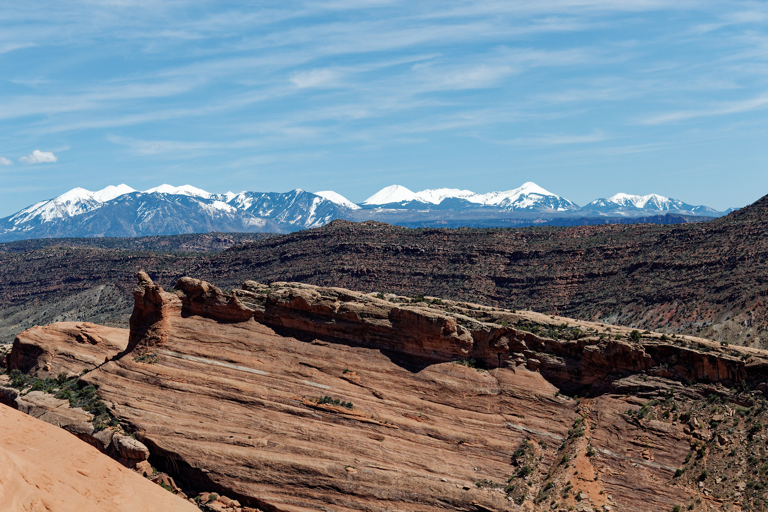
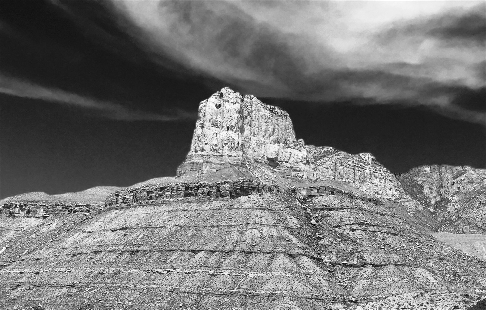
This class requires a MODERATE exertion level. Hikes are 4.8–8km (3–5 miles) across irregular terrain, scrambling up shale slopes and ledges of sandstone outcrops. The elevation of the Powder River Basin outcrops ranges from 1500–1800m (5000–6000 ft) and the climate is considered semi-arid. Temperatures in August range from 13–32°C (55–90°F). Most driving is on black-top roads, but some outcrops are reached via well-marked dirt roads.

Objectives

You will learn to:

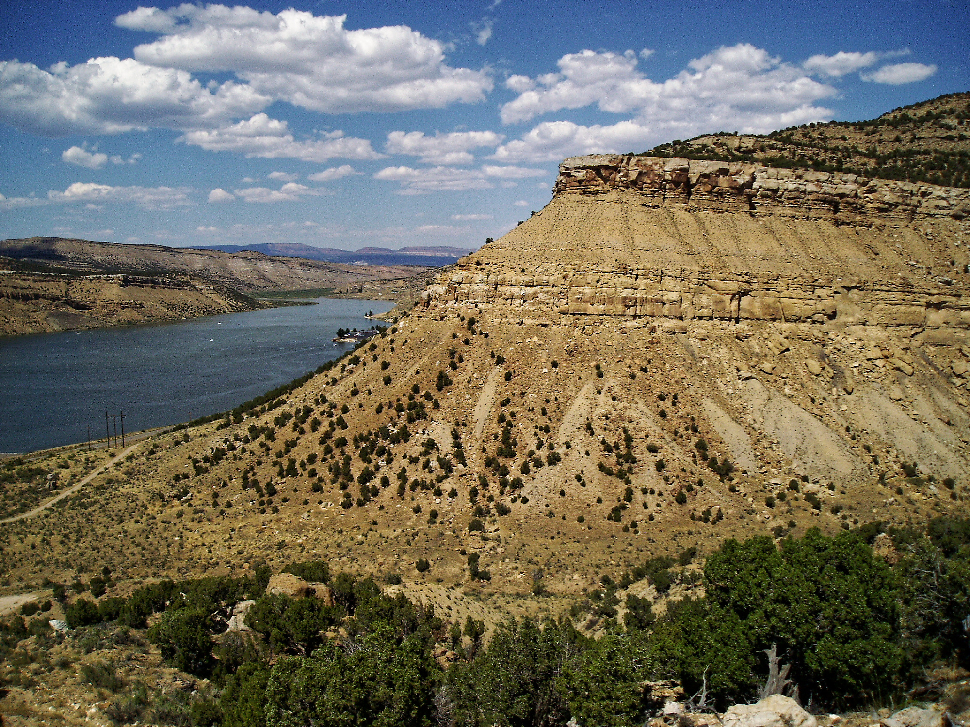
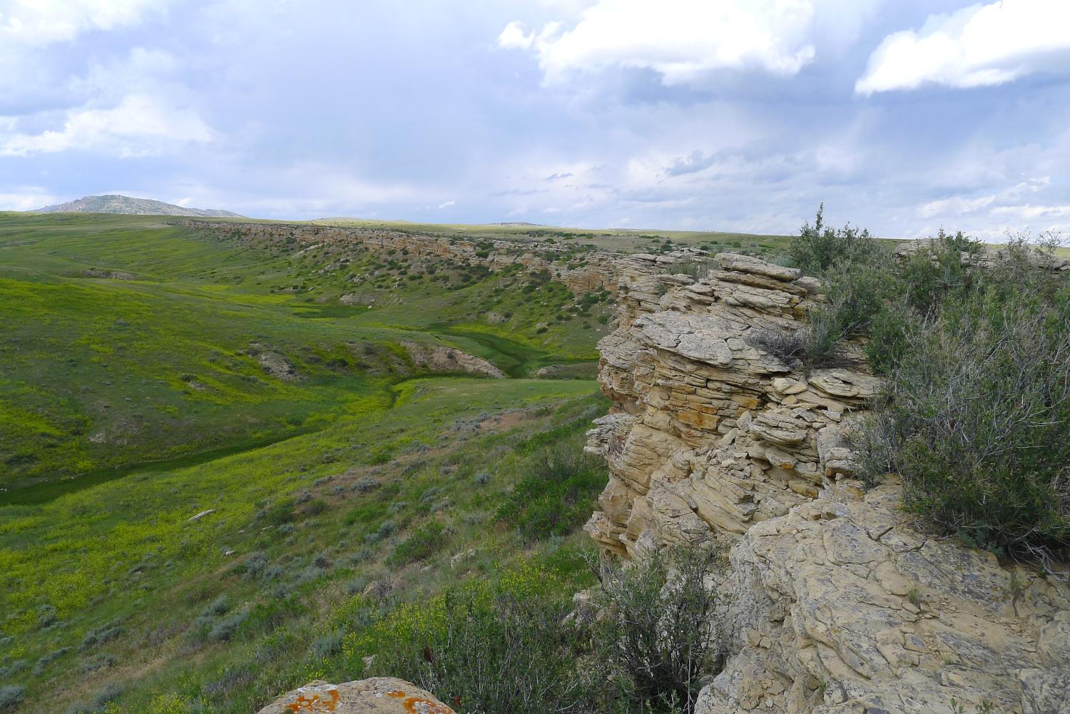
  1. Examine outcrops of alluvial plain, coastal plain, delta plain, offshore, shelf and distal basin hemipelagic source rocks within a sequence stratigraphic framework of Cretaceous strata along the margins of the Powder River Basin.
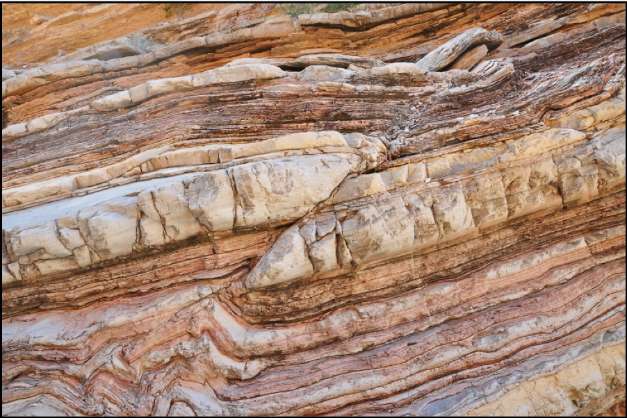
  2. Describe grain size, composition, sedimentary structures and biogenic structures of fine-grained source rocks of the Mowry Shale and Niobrara Formation.
  3. Evaluate physical parameters (e.g. TOC, porosity, PhiH, permeability, stiffness or brittleness, fractures, etc.) that define a successful tight oil play within the Mowry Shale and Niobrara Formation.
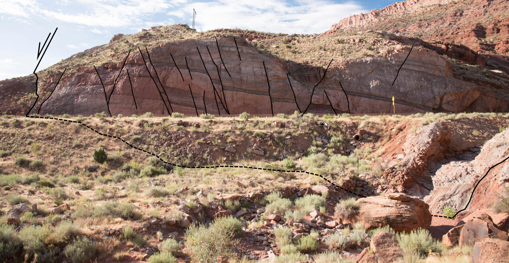
  4. Describe facies, facies architecture (grain size, composition, sedimentary structures and biogenic structures), facies associations of coastal plain, strand plain, delta plain, nearshore and shelf deposits of two major clastic wedges that prograded into the Cretaceous Western Interior Seaway: Frontier (Wall Creek and Turner) and Mesaverde (Shannon, Sussex, Parkman, and Teapot).
  5. Define and correlate parasequences, parasequence sets and sequences across the Powder River Basin (using outcrop sections and well logs) and predict where continuous oil accumulations or resource plays may occur within the basin.

Faulting, Fracturing and Mechanical Stratigraphy Field Seminar, San Antonio, Texas (G022)

Tutor(s)

David Ferrill: Institute Scientist, Space Science and Engineering Division, Southwest Research Institute.

Kevin Smart: Manager, Earth Science Section, Space Science and Engineering Division, Southwest Research Institute.

Overview

Superb exposures of Paleozoic and Mesozoic rocks in central and west Texas provide the opportunity to examine factors that influence the style and intensity of faulting, folding and fracture development, as well as the relationship between fracture spacing and mechanical layering. The outcrops offer analogs for deformation in both carbonate reservoirs and shale resource plays worldwide. The exposures range from map to fault block scale and provide the opportunity to explore the range of depositional facies and diverse tectonic regimes that influence the style and intensity of faulting, folding and fracture networks.

Duration and Logistics

A 7-day field course, comprising a mix of classroom lectures (5%), field lectures (65%) and field exercises (30%). The course begins and ends in San Antonio, Texas. A printed manual will be provided for each participant.

Level and Audience

Advanced. This course is intended for geoscientists, reservoir and production engineers, and petrophysicists who work with layered faulted and fractured reservoirs. It should be of particular interest to individuals working in unconventional or self-sourced plays (e.g. Eagle Ford, Austin Chalk). Basic familiarity with structural geology is expected of all participants.

Exertion Level

This class requires a MODERATE exertion level. Fieldwork is in the Hill Country near San Antonio where conditions are typically warm-hot and humid – the daily temperature range in fall is 15–30°C (60–85°F) – and in west Texas, where the climate is warm-hot and dry – the daily temperature range in fall is 7–27°C (45–80°F). Participants will be taking short to moderate hikes (less than 3.2km/2 miles) over flat to hilly terrain with a maximum elevation change of 200m (660 ft). Transport is by SUVs and most driving is on black-top roads. Some outcrops are reached via well-marked dirt roads.

Objectives

You will learn to:

  1. Perform structural interpretations using the basic concepts of faulting, fracturing and mechanical stratigraphy.
  2. Assess the role of mechanical stratigraphy and stress conditions on fracture and fault formation in sedimentary strata.
  3. Evaluate deformation mechanisms that operate in fault zones and the relationship between faulting and associated folding.
  4. Determine how complex structures control hydrocarbon migration and trapping in carbonate petroleum provinces.
  5. Effectively interpret many of the fault system features they will encounter on seismic and well data.
  6. Determine the controls on regional tectonic setting, stratigraphy and development in the areas they work.
  7. Assess local structural styles and relate deformation features to mechanical stratigraphy and structural position.

Shoreline and Shelf Reservoir Systems, Colorado (G013)

Tutor(s)

Mike Boyles: Retired Shell Oil; Affiliate Faculty, Colorado School of Mines.

Overview

This course contrasts two very different clastic shoreline systems by studying two sets of outcrops that were deposited at approximately the same time, about 100km (62 miles) away from each other. One set was deposited by classic river-feed, wave dominated delta systems and the other set had depositional strike-feed systems. The wave dominated deltas are common reservoirs in many basins. However, the less common strike-feed systems have a very different stratal architecture, which can result in the development of significant stratigraphic traps. Participants will develop competence in understanding clastic shoreline and shelf systems and applying sedimentology and sequence stratigraphic concepts to build depositional models and predict facies distributions.

Duration and Logistics

A 8-day field trip comprising a mix of classroom lectures (10%) and field time (lectures and exercises 90%). The course begins in Craig, Colorado, and ends in Steamboat, Colorado. Participants fly in and out of Hayden, Colorado.

Level and Audience

Advanced. Geologists, geophysicists and reservoir engineers working on fluvial / deltaic exploration and production projects. This course is especially relevant for people working reservoirs that were deposited under a tidal influence. The material is presented with minimal jargon so that reservoir engineers can get the maximum benefit of the material.

Exertion Level

This class requires a MODERATE exertion level. Scrambling over rock outcrops and steep sections will be required, but most hikes would be considered moderate. The longest hike is approximately 3.2km (2 miles). Outcrops are at elevations of 1300–2000m (3900–6000 ft). Weather conditions in NW Colorado can vary from warm and dry to cold and wet, with an early fall temperature range of 6–25°C (42–78°F). Transport will be in SUVs on paved and unpaved roads.

Objectives

You will learn to:

  1. Evaluate facies associated with wave dominated deltas, tidal shelf deposits and the often-under-recognized strike-fed tidally influenced shoreline deposits.
  2. Compare depositional dip and strike facies variations within a wave dominated delta complex at the regional scale.
  3. Distinguish deltaic distributaries from incised valley deposits associated with an unconformity.
  4. Identify facies and subsurface geometries of isolated, tidally dominated shelf reservoirs and understand possible links to older shoreline deposits and processes that controlled genesis of these stratigraphic traps.
  5. Use sequence stratigraphic principles to distinguish sequence boundaries, flooding surfaces, transgressive surfaces of erosion and maximum flooding surfaces.
  6. Begin to use the concepts of shoreline stacking patterns to better predict lateral continuity of shoreline systems.
  7. Make interpretations of reservoir systems from subsurface data based on the techniques practiced in the field.

Clastic Reservoirs: Stratigraphic and Structural Heterogeneities that Impact Reservoir Performance, Colorado and Utah (G012)

Tutor(s)

Mike Boyles: Retired Shell Oil; Affiliate Faculty, Colorado School of Mines.

Overview

The course investigates world-class outcrops to introduce all subsurface disciplines to a wide spectrum of stratigraphic and structural features commonly found in exploration and production. An active learning technique encourages participants to make initial observations and interpretations before group discussions. Lectures and exercises provide an awareness of reservoir architecture in a variety of stratigraphic and structural settings while outcrops demonstrate field- and reservoir-scale structural heterogeneities. Depositional environments studied include deltaic, eolian, fluvial, turbidites, tidal, lacustrine and coastal plain. Emphasis is placed on understanding flow characteristics (i.e. connectivity, Kv, Kv/Kh). A practical approach to using sequence stratigraphic concepts is also presented.

Duration and Logistics

A 6-day field course comprising a mix of classroom lectures (10%) and field exercises (90%). The course begins and ends in Grand Junction, Colorado, and visits outcrops in Utah and Colorado.

Level and Audience

Fundamental. This course is presented with minimal jargon so that non-geoscientists, such as reservoir engineers and petrophysicists, get the full benefit of the course. However, it would be particularly suitable for geoscientists working on fluvial/deltaic exploration and production projects, to show how common stratigraphic and structural variations can impact reservoir performance.

Exertion Level

This class requires a MODERATE exertion level. Scrambling over rock outcrops and steep sections will be required, but most hikes would be considered moderate. The longest walk is approximately 4.8km (3.2 miles). Outcrops are at elevations of 1200–2500m (4000–8200 ft). Weather conditions in NW Colorado and eastern Utah can vary from warm and dry to cold and wet, with an early fall temperature range of 5–23°C (41–73°F). Transport will be in SUVs on black-top and unpaved roads.

Objectives

You will learn to:

  1. Divide subsurface reservoirs into flow units that capture key reservoir flow characteristics and heterogeneities at a variety of reservoir model scales.
  2. Communicate and discuss flow unit properties between subsurface team disciplines.
  3. Understand detailed facies analysis within deposits of wave dominated deltas, fluvial dominated deltas, fluvial systems, tidal / estuarine, eolian and turbidites.
  4. Recognition of key facies in cores and logs.
  5. Use key sequence stratigraphic concepts in a practical and predictive way.

Interpretation and Analysis of Normal Fault Systems for Trap Analysis and Reservoir Management, Moab, Utah (G006)

Tutor(s)

Bob Krantz: Consulting Geologist and Adjunct Professor, University of Arizona.

Peter Hennings: Research Professor, UT Austin, Texas.

Overview

Trap analysis for exploration risking and field management requires complete 3-D characterization, especially where faults are critical elements. The ability of faults to seal and leak can vary in space and over geologic and field management timeframes. Explorationists and development geologists must understand fault characteristics, integrate appropriate data and perform specific analyses when working with faulted reservoirs. The Moab fault system and surrounding geology provide exceptional examples of trap-scale structures with fault zone characteristics that vary depending on offset and juxtaposed rock type, which are documented to have both sealed and leaked over geologic time in patterns that are clearly expressed. Reframing these outcrops to subsurface application is immensely valuable in understanding static and dynamic reservoir behavior.

Duration and Logistics

A 6-day field course comprising a mix of classroom lectures (30%), practical exercises (20%) and field visits to some of Earth’s best-exposed and thoroughly studied outcropping fault systems (50%). The manual will be provided in digital format and you will be required to bring a laptop or tablet computer to the course. Laminated posters will be used extensively in the field for annotation and discussion. The course is based in Moab, Utah, with participants arriving in and departing from Grand Junction, Colorado.

Level and Audience

Advanced. This course is intended for geoscientists and reservoir engineers who work with layered faulted reservoirs. Participants would benefit from having a basic familiarity with structural geology.

Exertion Level

This class requires a MODERATE exertion level. The fieldwork will involve walking up and down slopes over rough ground. There will be walks of up to 1.6km (1 mile) on most days, the most strenuous being an ascent (and descent) of 60m (200 ft) over rocky ground as part of a 3.2km (2-mile) walk. The altitude of the field area ranges from 1200–1750m (4000–5800 ft), which may lead to unexpected shortness of breath for some. The weather should be pleasant with typical highs of 27°C (80°F) in the fall, but early morning temperatures may be below 5°C (40°F) on some days. Transport will be by mini-van or SUV on paved and graded dirt roads.

Objectives

You will learn to:

  1. Understand how normal faults form, displace and link in 2-D and 3-D.
  2. Understand how fault systems evolve over geologic time.
  3. Characterize controls on mechanical stratigraphy.
  4. Identify fault zone deformational fabrics and mechanics.
  5. Understand static and dynamic fault seals, fault permeability and seal effectiveness.
  6. Develop reservoir compartmentalization models.
  7. Predict fault reactivation likelihood for application to seal failure and induced seismicity.
  8. Apply 3-D fault framework interpretation methods.

Sequence Stratigraphy of the Permian Basin, Texas and New Mexico (G002)

Tutor(s)

Rene Jonk: Director, ACT-Geo Consulting and Training; Honorary Professor, University of Aberdeen.

Overview

This field course is designed for geoscientists and engineers exploring and developing plays in mixed carbonate-siliciclastic systems; it is relevant to those working in the Permian Basin. The course will enhance each participant’s ability to distinguish depositional facies and play elements, based on seismic features, stratal geometries, sequence stratigraphy, diagenetic changes impacting reservoir quality and depositional models. Subsurface data from the Permian Basin, including seismic, well logs and cores, will be used to establish a sequence stratigraphic framework for the basin, with emphasis on the prediction of play element presence and quality, both for conventional and unconventional resources, including discussions on production behavior and strategies.

Duration and Logistics

A 5-day field course; a mix of field activities (60%) and classroom lectures and exercises (40%), with long days (typically 10 hours). The course begins and ends in El Paso, Texas. The first night is spent in El Paso; subsequent nights are spent in Carlsbad, New Mexico.

Level and Audience

Advanced. This course is intended for geoscientists, petrophysicists, engineers and managers who are seeking a comprehensive examination into the seismic stratigraphy of the Permian Basin.

Exertion Level

This class requires a MODERATE exertion level. Fieldwork is in west Texas and southeast New Mexico, where the weather is arid and usually hot, although cold and wet weather is possible in the spring and fall when daily temperatures range from 5–25°C (40–80°F). The course includes walks of a moderate length (up to 3.2km/2 miles) with an ascent of 305m (1000 ft), frequently over very steep and uneven ground. Transport on the course will be by mini-van. Most of the driving is on black-top roads, with some driving on graded dirt roads.

Objectives

You will learn to:

  1. Analyze exposures of carbonate shelf and ramp to siliciclastic basinal systems, in order to relate depositional facies to seismic scale geometries and sequence stratigraphy.
  2. Examine seismic scale outcrop geometries, document outcrop facies and demonstrate similarities to productive intervals in the Permian Basin.
  3. Understand how subaerial exposure, marine diagenesis and early near-surface dolomitization can affect ultimate reservoir porosity and permeability and overall reservoir geometry in subsurface.
  4. Assess changes in carbonate facies and relate these changes to depositional environments.
  5. Apply Walter’s Law and chronostratigraphic principles in core, well log and seismic interpretation, and relate to prediction of play elements and best productive intervals for unconventional resources.
  6. Analyze sequence stratigraphy for carbonates and mixed carbonate-clastic depositional systems.
  7. Interpret carbonate sequence stratigraphic patterns from outcrop, well log and seismic data.