World-class training for the modern energy industry

Reservoir Characterization of Deepwater Systems, San Diego, California (G046)

Tutor(s)

Rene Jonk: Director, ACT-Geo Consulting and Training; Honorary Professor, University of Aberdeen.

Overview

Submarine canyons and deepwater channels are the primary conduits for the transfer of coarse sediments from the shelf to deep-water fans and they are today major targets for petroleum exploration. Southern California has had a long and complex geologic history that has involved many episodes of deepwater sedimentation in a variety of settings ranging from the Paleozoic passive margin of the North American craton to Mesozoic forearc and arc settings to Cenozoic transform, pull-apart, and continental borderland basins. These settings feature deep-water deposits in which both large and small submarine channels and fans played major roles as sediment transport routes and sites of sedimentation.

Duration and Logistics

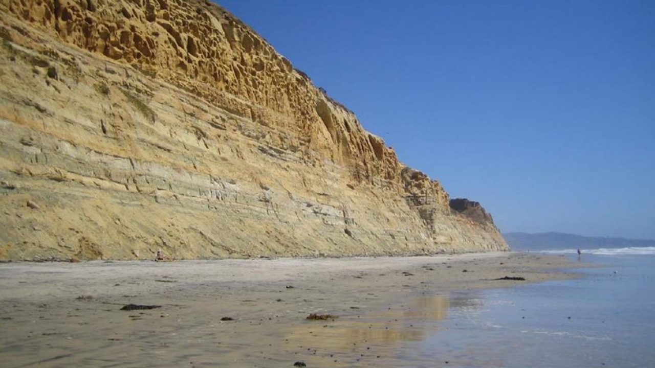
6 days; a mix of outcrop examination and discussion (70%) and supporting classroom lectures (30%).  The field course is conducted in southern California along the coastline north of San Diego.

Level and Audience

Advanced. Geologists, geophysicists, and petroleum engineers working on deep water reservoirs from exploration to production.

Exertion Level

This class requires a MODERATE exertion level. Access to the coastal cliff outcrops is via sandy beaches, with most walks under 2 km. Some shallow wading on a sandy beach is also necessary in order to visit some outcrops.

Objectives

You will learn to:

  1. Review deepwater lithofacies nomenclature and definitions, common lithofacies associations, and interpret lithofacies in outcrops and cores.
  2. Interpret environments of deposition (EoD’s) and related reservoir architecture, lithofacies associations, and diversity.
  3. Interpret sequence stratigraphic surfaces in outcrop, logs, and seismic in DW settings and related to vertical stacking of facies.
  4. Use core and well-logs to interpret EoD’s.
  5. Evaluate reservoir geometry and connectivity in different EoD’s.
  6. Recognise the Do’s and Don’ts of using outcrops as reservoir analogs
  7. Apply outcrop information as analog for reservoir model building
  8. Evaluate seismic response, including geometry, facies, and acoustic response in deepwater EoD’s
  9. Apply the criteria for the identification of Composite Sequences, Sequence Sets, and Depositional Sequences and their components in outcrops, cores, well logs, and seismic
  10. Use interpretation and mapping techniques for cores, well-logs, and seismic lines in deepwater settings, from Exploration to Production business scales
  11. Apply criteria and mapping strategies for play elements in deepwater depositional settings
  12. Identify and map play fairways in deepwater settings.

Geologic Carbon Storage for Geoscientists and Engineers (G551)

Tutor(s)

Alex Bump: Research Science Associate, University of Texas at Austin.

Seyyed Hosseini: Research Professor, University of Texas at Austin.

Katherine Romanak: Research Scientist, University of Texas at Austin.

Overview

This course empowers attendees to develop and apply their skills to the growing industry of Carbon Capture Utilisation and Storage (CCUS). Attendees will be guided through the lifecycle of a CCUS project with an emphasis on key concepts, processes and workflows of the CCUS industry. Focus will be on developing the geoscience and engineering skills needed to progress a project.

Duration and Logistics

Classroom version: A 3-day course comprising a mix of lectures, case studies and exercises. The manual will be provided in digital format and participants will be required to bring a laptop or tablet computer to follow the lectures and exercises.

Virtual version: Five 4-hour interactive online sessions presented over 5 days.

Level and Audience

Intermediate. The course is intended for petroleum geoscientists, reservoir engineers and first-level leaders looking to adapt their skills to carbon capture and storage.

Objectives

You will learn to:

  1. Outline the regulatory, policy and financial drivers and constraints for CCUS.
  2. Describe the subsurface requirements for a successful storage project, including similarities and differences with oil and gas exploration.
  3. Understand the workflow and perform the key tasks for defining, developing and permitting a CCUS project, including site selection, characterisation, risk assessment and monitoring for operational and post-operational phases.
  4. Apply your subsurface knowledge and skills in oil and gas development to the concepts, processes and workflows of the CCUS industry.
  5. Estimate CO2 storage capacity in saline aquifers at reservoir and basin-scales.

Clastic Reservoirs: Stratigraphic and Structural Heterogeneities that Impact Reservoir Performance, Colorado and Utah (G012)

Tutor(s)

Mike Boyles: Retired Shell Oil; Affiliate Faculty, Colorado School of Mines.

Overview

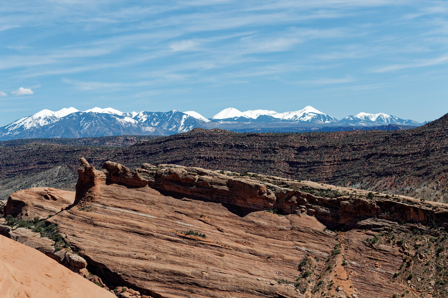
The course investigates world-class outcrops to introduce all subsurface disciplines to a wide spectrum of stratigraphic and structural features commonly found in exploration and production. An active learning technique encourages participants to make initial observations and interpretations before group discussions. Lectures and exercises provide an awareness of reservoir architecture in a variety of stratigraphic and structural settings while outcrops demonstrate field- and reservoir-scale structural heterogeneities. Depositional environments studied include deltaic, eolian, fluvial, turbidites, tidal, lacustrine and coastal plain. Emphasis is placed on understanding flow characteristics (i.e. connectivity, Kv, Kv/Kh). A practical approach to using sequence stratigraphic concepts is also presented.

Duration and Logistics

A 6-day field course comprising a mix of classroom lectures (10%) and field exercises (90%). The course begins and ends in Grand Junction, Colorado, and visits outcrops in Utah and Colorado.

Level and Audience

Intermediate. This course is presented with minimal jargon so that non-geoscientists, such as reservoir engineers and petrophysicists, get the full benefit of the course. However, it would be particularly suitable for geoscientists working on fluvial/deltaic exploration and production projects, to show how common stratigraphic and structural variations can impact reservoir performance.

Exertion Level

This class requires a MODERATE exertion level. Scrambling over rock outcrops and steep sections will be required, but most hikes would be considered moderate. The longest walk is approximately 4.8km (3.2 miles). Outcrops are at elevations of 1200–2500m (4000–8200 ft). Weather conditions in NW Colorado and eastern Utah can vary from warm and dry to cold and wet, with an early fall temperature range of 5–23°C (41–73°F). Transport will be in SUVs on black-top and unpaved roads.

Objectives

You will learn to:

  1. Divide subsurface reservoirs into flow units that capture key reservoir flow characteristics and heterogeneities at a variety of reservoir model scales.
  2. Communicate and discuss flow unit properties between subsurface team disciplines.
  3. Understand detailed facies analysis within deposits of wave dominated deltas, fluvial dominated deltas, fluvial systems, tidal / estuarine, eolian and turbidites.
  4. Recognition of key facies in cores and logs.
  5. Use key sequence stratigraphic concepts in a practical and predictive way.

Sequence Stratigraphy and its expression on Seismic, Logs and Cores (G001)

Tutor(s)

Rene Jonk: Director, ACT-Geo Consulting and Training; Honorary Professor, University of Aberdeen.

Overview

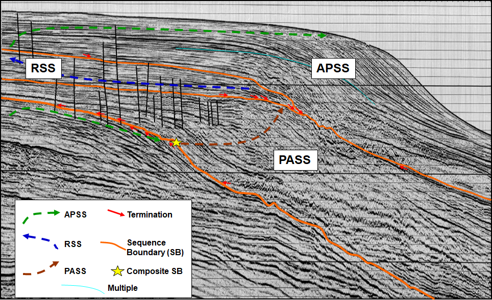
The application of sequence stratigraphy allows for making geologic interpretations of cores, well logs, seismic and outcrop data within a predictive stratigraphic framework. These predictions can be applied to play and prospect definition and evaluation, pre-drill predictions and discovery appraisal and field development strategies. This course introduces the sequence stratigraphic method and presents workflows and tools to describe, correlate and map strata within a predictive framework using typical subsurface (core, well log and seismic) data. The terminology of surfaces, systems tracts, sequence sets and stratigraphic hierarchy will be described and applied to subsurface data exercises in terrestrial, shallow marine and deep marine depositional settings across clastic and carbonate settings and applied to conventional and unconventional play types. The emphasis will be on the recognition and mapping of play elements (source, seal, reservoir and trap) from exploration to production scales.

Duration and Logistics

Classroom version: A 4-day course comprising a mix of classroom lectures and discussion (50%), and hands-on exercises with subsurface datasets (50%). The lecture materials will be provided in digital format and participants will be required to bring a laptop or tablet computer to follow the lectures and exercises. Exercises manuals will be printed for each student to enhance learning by interpreting using pencil on paper.

Virtual version: Ten 3-hour interactive online sessions presented over 5 days. A digital manual and hard-copy exercise materials will be distributed to participants before the course. Some reading and several exercises are to be completed by participants off-line.

Level and Audience

Intermediate. This course is intended for geoscientists (reservoir modellers, seismic interpreters, sedimentologists), reservoir engineers and petrophysicists who want to understand and apply the concepts of sequence stratigraphy to solve business problems.

Objectives

You will learn to:

  1. Understand the sequence stratigraphic method, terminology and application.
  2. Contrast the various approaches to sequence stratigraphy.
  3. Apply the concept of facies, facies stacking and shoreline trajectories to define sequences, surfaces and system tracts.
  4. Evaluate depositional controls on sequences in non-terrestrial, shallow marine and deep marine environments.
  5. Assess and interpret cores, well logs and seismic lines to characterize and map hydrocarbon play elements in different settings using the sequence stratigraphic method.
  6. Implement sequence stratigraphic methods to predict play element presence, adequacy and risk from seismic data for exploration play and prospect definition.
  7. Apply sequence stratigraphic frameworks to evaluate connectivity in discovery appraisal and field development.
  8. Apply sequence stratigraphic methods to define seal adequacy for subtle and stratigraphic traps in various depositional settings.