World-class training for the modern energy industry

Collecting geoscience data does not de-risk projects. So why collect it? And what does risk mean?

Geoscientists need to advance their skills in predicting how an exploration prospect may fit into its mineral system and portfolio, knowing the possible value from future data acquisition programs and understanding the likelihood of them happening. This is future-facing exploration.

By Graham Banks, Route To Reserves and Southern Geoscience Consultants

There are numerous statements in exploration industry, corporate and academic literature about projects and exploration prospects being “de-risked” by additional data, analysis or analogues.

Unfortunately, this message is not correct. After gaining more information and knowledge, organisations may still proceed with unwise decisions, or continue along a course of action that erodes value for the benefactor/investor. In terms of “de-risking” a mineral prospect, additional information does not change the “risk” that the prospect could become a discovery. The dice were rolled by Nature millions to billions of years ago. The extra information serves to reaffirm or change the team’s perception about the success and failure scenarios of their prospect.

Let’s continue with the way industry uses “de-risking” for one more paragraph. One would assume that a mineral deposit would be “de-risked” after >$100 million had been spent over a decade drilling tens of kilometres of core, conducting a positive feasibility study and receiving the go-ahead to start mining. Yet we see news articles reporting how some ore reserves shrink after mining has started, despite all that data collection and modelling.

Two other common statements in exploration literature and corporate statements are that: (a) early exploration is “high risk, high reward”, and (b) progressing an exploration project reduces the risk. Statements like these may persuade investors to fund geoscience surveys and analyses, but high risk events can arise any time between early stage exploration and mining e.g.:

  • A mine event leading to injuries or fatalities.
  • Political decisions to raise mining sector taxes.
  • Economic conditions leading to commodity devaluation.

These types of erroneous statements may originate from an inaccurate understanding of “risk” amongst geoscientists. Or worse, a variety of inaccurate definitions and uses of “risk” amongst geoscientists. The implications can be severe: disagreement, reluctance to co-operate, overconfidence in a questionable prospect, hazards at the drilling rig, confused investors, wasted dollars, loss of credibility, etc.

Exploration geoscientists frequently use words like risk, value and uncertainty to promote their work and projects to management, investors, policy makers, etc. Therefore, it is crucial that geoscientists use these terms correctly and consistently. What is your definition of geological risk: a landslide; the drill bit not getting through the permafrost; not enough soil geochemistry data? Inconsistent vocabulary doesn’t help decision makers.

Few geoscientists are taught the implications of using words like risk, value, probability and uncertainty during university geoscience classes or professional development courses. Which is strange, because universities and training courses deliver standard definitions and categories for lithologies, species of fossils, sediment deposition settings, chemical formulas of minerals, etc.

So, where do geoscientists learn to use such terms accurately and appropriately? This Holistic Exploration Workflow for Critical Minerals Exploration course led by Graham Banks and Steven Fehr bridges a knowledge gap between higher education and the minerals-mining industry. Graham and Steve have spent most of their careers conducting and QCing exploration programs and business opportunities, through the lens of geoscience integrated with strategy, risk, uncertainty, probability and value of information analysis.

This professional development course guides attendees through the correct uses of risk, value, uncertainty, probability of success for critical mineral exploration and modelling. It also informs attendees about biases, the mineral system, deterministic and probabilistic approaches, accuracy versus precision, different types of value, and the value of acquiring new geoscience information.

Three other subject matter experts share their industry knowledge during the course to broaden its themes into a holistic exploration strategy:

Amit Sharma (Mining Sector Lead, Matrix Solutions Inc.) will explain the Environmental, Stakeholder and Governance considerations (ESG) required at each of regional, district and local exploration phases. Incorporating ESG into the early exploration phase is important to: raise additional capital; check the future mining operation could be feasible; practice environmental stewardship; ensure correct stakeholder engagement; understand the regulatory landscape, water resources and climate adaptation, etc.

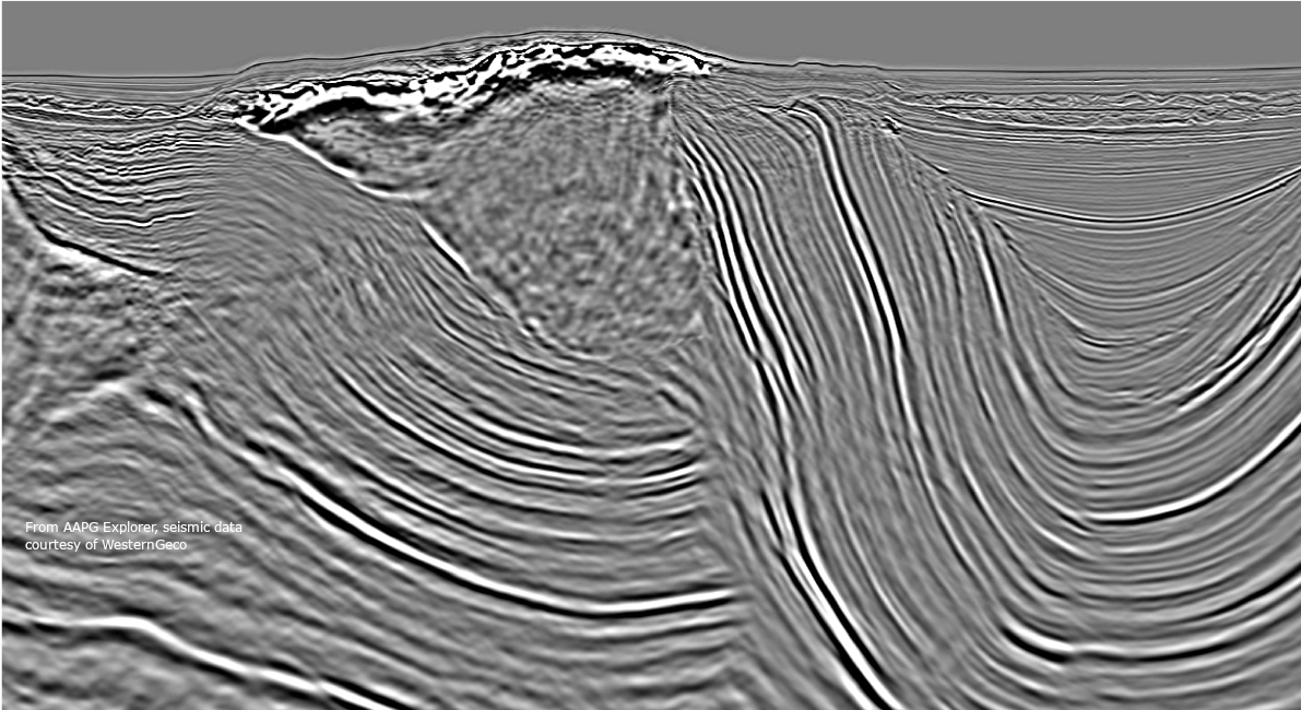
Colm Murphy (Chief Geoscientist, Bell Geospace) will show how full tensor gravity gradiometry is adept at mapping sub-surface structure.

Robert Hearst (Consulting Geophysicist – Americas, Southern Geoscience Consultants) will summarise the use of geophysical techniques to identify mineral system ingredients.

Most mineral exploration courses and tasks are about increasing interpretation detail and precision for already-collected data. Usually in a small geographic area. Often located next to historic (i.e. not presently viable) mines. This is history-facing exploration. The big-picture consequence is that “conventional” mineral exploration and prospecting is not efficient. Only a few big discoveries are made each year, despite $ billions spent. According to Rio Tinto, the chance of a greenfield mineral target becoming a “world-class” mine is 1 in 3333. Many exploration and geoscience projects should have stopped at an early stage. In recent years, the industry generated $1 for every $2 spent. Investors are not receiving sufficient return on their investment. And now, mineral exploration needs to go deeper under sediment-vegetation cover and into under-explored regions. How can geoscientists help decision-makers better allocate budget into a deep rock volume with sparse information?

Geoscientists need to advance their skills in predicting: (a) how an exploration prospect may fit into its mineral system and portfolio, (b) the possible value from future data acquisition programs and (c) the likelihood of them happening. This is future-facing exploration: the drilling programs and results haven’t happened yet. Geoscientists need an efficient method to increase exploration chance of success, e.g., rate exploration programs and portfolios by a mineral system’s possible extent and value. Exploration expenditure may have most impact when directed at the weakest links in the team’s success case model. Graham Banks and Steven Fehr’s course teaches the foundations of that logic:

  1. Understand some of the techniques and tasks of an industry exploration geoscientist.

  2. Put a mineral exploration project into province, mineral system and play context.

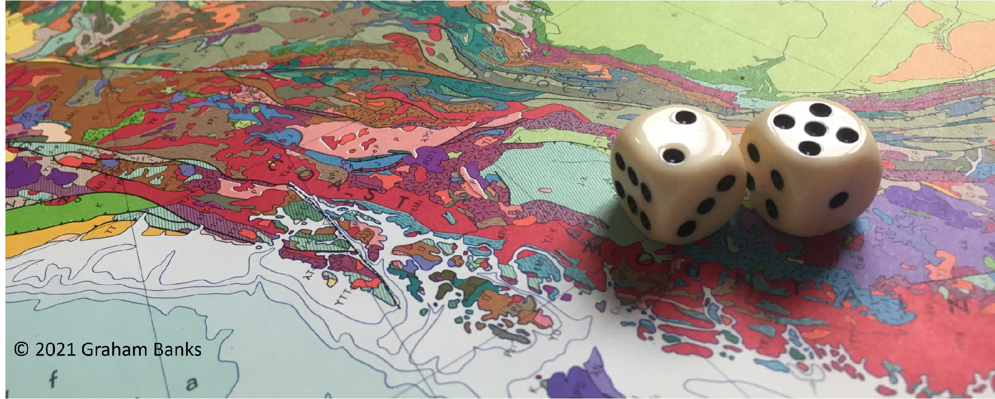
  3. See mineral exploration as a high-risk game of chance, that requires a probability of success estimate and approach.

  4. Adapt best-practice exploration techniques from other commodities into the critical minerals sector.

  5. Create and efficiently communicate maps and cross sections to estimate the migration pathways and deposition locations of commodities.

  6. Design a mineral system framework and translate it into the data surveys that would improve confidence in an exploration project.

  7. Recognise the value of collaboration, multiple working hypotheses and the team’s range of experiences (the opposite of precision).

  8. Identify and mitigate the (often detrimental) biases that geoscientists bring to projects.

  9. Integrate environmental, social and governance (ESG) factors into the exploration workflow at their correct timings and scales.

  10. Add value (not just cost) to the decision-making process, to improve Decision Quality.

Let’s return to the first question of this article. Why do geoscientists seek more data if it does not “de-risk” a mineral prospect or change the “risk” that the prospect could become a discovery? Some reasons to acquire information should be to: (a) provide decision-makers with more confidence and certainty when making decisions, (b) narrow the uncertainty range of each parameter in the success case geological model, (c) reassess and revise how business opportunities have been ranked.

If the topics in this professional development course resonate with your exploration tasks and requirements, or address your team’s challenges, book a seat while you can.

Graham Banks (Route To Reserves, Southern Geoscience Consultants)

https://www.linkedin.com/in/graham-banks-aba5bb26/

route2reserves@gmail.comgraham.banks@sgc.com.au

Steven Fehr

https://www.linkedin.com/in/stevefehr/

Amit Sharma (Matrix Solutions Inc.)

https://www.linkedin.com/in/amit-sharma-a979b935/

Colm Murphy (Bell Geospace)

https://www.linkedin.com/in/colm-murphy-6b378910/

Robert Hearst (Southern Geoscience Consultants)

https://www.linkedin.com/in/rob-hearst-53a15919/

Energy and Power Density: the deepwater advantage

In the oil and gas industry, the size of a discovery matters. And these days, so does the environmental footprint of extracting its resources. As the world continues to research sustainable energy sources, one geologist – in a rare twist – is looking to giant deepwater oil and gas fields as part of the solution rather than as part of the problem. Based on an article by Heather Saucier that appeared in the April 2020 AAPG Explorer, this version was edited by Henry S. Pettingill and Dr Paul Weimer.

In the oil and gas industry, the size of a discovery matters. And these days, so does the environmental footprint of extracting its resources. As the world continues to research sustainable energy sources, one geologist – in a rare twist – is looking to giant deepwater oil and gas fields as part of the solution rather than as part of the problem.

“If we’re looking for efficient sources of energy with manageable environmental footprints, deepwater may be the place to look,” said Henry S. Pettingill, consultant and former geologist for Shell and Noble Energy. “While most of the media focus seems to be on the environmental strain related to consumption of energy, we should also consider the environmental cost of extracting and producing that energy.”

Pettingill is seeing deepwater oil and gas production in a more favorable light – both to the industry and to the environment. Most notably, about half the reserves of the deepwater giant fields are natural gas, which emits far lower emissions than coal or oil. Since there is abundant supply and the economics can be favorable, many see it as the bridge fuel between now and the day that renewables and safe nuclear can provide a more substantial portion of our global energy mix.

RESERVE DENSITY

Pettingill has been studying deepwater giant oil and gas fields, comparing their reserves to their surface areas, ranking them according to their “reserve density”, or their volume in hydrocarbons per square meter. ”Because hydrocarbon volumes are expressed in energy equivalents (e.g. barrels of oil equivalent or “boe”), reserve density is also energy density, and this allows us to visualize how much energy is concentrated in one place, and generally speaking, points to the level of economic and environmental efficiencies associated with extraction of those reserves.”

His first step was to produce a chart of the giant deepwater fields to determine which fields have the largest and smallest reserves per areal footprint (Figure 1). These fields were chosen because they represent the diversity in areal footprint and net pay thickness. From this visual technique, we can appreciate fields with vast areas but relative low net pay – “pancake-shaped” – from those with smaller areas but relatively large net pay – “pipe-shaped”, with the latter having higher reserve density. The Mars-Ursa complex in the northern Gulf of Mexico topped the list with an estimated 2.3 billion barrels oil equivalent contained within an area significantly less than 100 square kilometers, giving it a reserve density of about 40 barrels per square meter. The Mars field occupies an area smaller than most Houston neighborhoods, or about 70% of the area of Houston’s Bush Intercontinental Airport.

“Mars is a unique field,” said Dr Paul Weimer, who was Pettingill’s co-author in a presentation on the topic at the AAPG Global Super Basins Conference in February 2020. “It has a minimum of 14 reservoir levels in a very small area, and they are all stacked on top of each other.”

Figure 1: Areal footprints of select Giant Deepwater fields, along with their net pay thicknesses, all drawn at equal scale. Left: Field with Deep marine sand reservoirs. Right: Field with Carbonate reservoirs. Arrows denote the Reserve Density in barrels of oil equivalent per square meter (boe/m2).

Egypt’s Zohr gas field is close behind Mars, with more than 23 trillion cubic feet of recoverable gas distributed over an area of roughly 100 square kilometers, and a reserve density of about 38 barrels per square meter.

At the other end of Pettingill’s spectrum, the Scarborough gas discovery off the northwest coast of Australia has a reserve density of just 1.5 barrels of oil equivalent per square meter – its area spanning a vast 800 square kilometers, with recoverable volumes of 7.3 trillion cubic feet. Scarborough would occupy about half of the entire Houston metropolitan area. It is notable that this appraised discovery has yet to come onstream 42 years after discovery.

Figure 2: Reserve Density in barrels of oil equivalent per square meter (boe/m2).Red = Gas Fields, Green = Oil Fields (most with associated gas).

POWER DENSITY

Robert Bryce, in his 2010 book “Power Hungry”, defined power density as the amount of power that can be generated per square meter. Using the reserve densities of each field, Pettingill calculated their “power density”, in both watts and barrels of oil equivalent per day.

He then produced a power density chart comparing deepwater fields to a host of other power sources in a quest to learn which provided the most power and simultaneously took up the least amount of space (Figure 4).

Figure 3: Flow rates from Deepwater fields. Since barrels of oil equivalent is an energy equivalent and power is energy per time, this is a comparison of the power output of individual wells.

The Mars-Ursa field is the standout example, delivering more than 500 watts per square meter. Also, impressive, Israel’s Tamar gas field, because it has a high reserve density and flow rate, produces about 100 watts per square meter.

In contrast, a typical two-reactor nuclear plant from South Texas produced 56 watts per square meter, while in 2010 the average onshore U.S. gas well produced roughly the same amount.

Farther down the efficiency line are sustainable energy sources. The average solar plant delivers about 7 watts per square meter, whereas wind farms deliver about 1 watt per square meter. At the lowest end, cornfields used for ethanol deliver less than one-tenth of a watt per square meter.

“Wind farms, solar energy and unconventional hydrocarbons require very large amounts of area per megawatt generated,” Pettingill said. “A deepwater field with a small footprint is much more economically and environmentally efficient.”

For example, to replace the Mars-Ursa power output with corn ethanol, an area about one-half the state of Texas would have to be covered in cornfields, he said.

And, unlike many shale plays – which often require an extensive pipeline network connecting many wells over many miles – offshore fields use limited pipelines and do not rely on a steady stream of trucks on the road to support drilling, hydraulic fracturing and production operations and in some cases oil evacuation.

Figure 4: Left: Power Output of typical fuel sources used to generate power, including the Mars-Ursa Complex of the Gulf of Mexico deepwater and the Tamar gas field of the deepwater Levant basin. Right: Power Density of typical fuel sources, shown in comparison to the deepwater fields Mars (U.S. Gulf of Mexico), Tamar (Israel Levant) and Scarborough (Northwest Shelf, Australia)

Because deepwater is known for very high flow rates, hydrocarbons can be quickly pumped straight to a processing facility. “It gets to the user much faster, which in turn provides an economic advantage, with lower environmental burden from extraction than some other forms of energy,” Pettingill said.

Recalling his time at Noble Energy, he said, “The day we turned on the Tamar gas field, Israel was able to replace coal with natural gas as the primary feedstock to their power plants. Prior to that day, they never had a substantial reliable natural gas source, and now they are exporting gas.” Noble stated at a 2013 conference that “The amount of coal removed from Israel’s energy supply is the equivalent to taking every car off the highway in Israel for 17 years.”

He added that if Israel were to replace the power generation of the Tamar gas field with corn ethanol, then cornfields 11 times the area of Israel would be needed for the same amount of power.

Pettingill does acknowledge that offshore production can only be considered environmentally sound if strict measures are followed to prevent spills, leaks and damage to the seabed, and other forms of harm to wildlife.

In reflecting on the history of the industry, in which economics has always driven exploration and development, Pettingill suggests that reserve density and power density be factored into the equation, especially as the world gravitates toward projects that balance economic development with environmental needs.

“Oil and gas are still good. What we do matters,” he said. “We are delivering something that cannot be replaced in an economically competitive way. But the message here is that deepwater production is economically friendly and environmentally manageable.”

Pettingill teaches two courses with GeoLogica, one in the field and one in the classroom. His field course in the Pyrenees of Spain, Sand-rich Turbidite Systems: From Slope to Basin Plain (G016), examines the types of deposits that form the reservoirs in many of the fields discussed in this article. His classroom course is Creativity and Innovation Skills for E&P (G029). It is co-taught with Niven Shumaker and explores the types of “out of the box” thinking that Henry used to develop the energy density views presented above.

April, 2020

Training in the Time of Corona

As the world continues to adapt to the restrictions imposed by the Coronavirus lockdown, training companies are having to investigate new ways to educate and engage clients. The lessons GeoLogica learn may provide new insight into how our business emerges in the post-Corona landscape.

For some years now portions of education, training and learning have been moving into the online realm, most notably through self-paced methods, including reading, pre-recorded lectures and quizzes, and these have proved useful for some fundamental topics. While we feel there is nothing better than direct interaction with an experienced instructor, in a world where direct interaction is off the table, we want to access the next best alternative.

We see a solution in remote delivery where the online teaching is live in real-time and combined with periods of self-paced learning through reading and quizzes. A key challenge will be to establish the optimal length for each element. Traditional lectures and meetings generally last no longer than an hour or so, in order for peoples’ attention to remain focussed – any shorter and the topic may not be sufficiently developed, any longer and concentration can wander. Online attention spans are thought to be considerably shorter – the ideal length of time for a talk or lecture may be only 30 minutes before breaking for a quiz, exercise or Q and A session. Live sessions could perhaps last 60–90 minutes if there are plenty of breaks and thought is given to issues associated with staring at screens for prolonged periods of time. Materials for self-paced learning also need to be thought-out – they should be well-structured and broken into smaller sections to tie-in with the live learning and ensure not too much is crammed into the time between lectures.

A key consideration for us is working with each instructor to find the model that works best for him or her. Some will prefer numerous short and punchy lectures, while others will opt for longer sessions that allow for more in-depth treatment of a topic. Some will rely heavily on interactive exercises and others on demonstrations. In every case, we want a solution that allows for live visual and audible feedback from course participants to maintain class momentum and enthusiasm.

Taking all these factors into account, GeoLogica is pleased to announce that we can offer online training as an in-house option for most of the courses in our portfolio. Topics range from Fundamental to Advanced courses in Basin Analysis, Resource Plays, Structural Geology, Geophysics, Evaluation Methods, Geophysics, Reservoir Characterization, Depositional Systems and Reservoir Engineering. Most of our courses can be tailored to fit an individual company’s needs and the delivery method can also be modified to suit. You can download a list of our latest online course offerings here or contact us with your requirements.

All of us at GeoLogica believe the most effective teaching is face-to-face – yes, it is more expensive but, in the end, people learn best through direct, human interaction and experience. Attending a classroom course with your peers and colleagues also provides an unquantifiable stimulus of human interaction, which helps develop a deeper understanding of the topic. And in the field, the full sensory immersion of observing outcrops provides an unbeatable learning environment. Nevertheless, there is a space for online leaning, so long as it is designed to be efficient, effective and engaging. Advantages can include reduced need for travel, less time away from the office for participants and cost savings. And, in these challenging times, social distancing.

‘Experiential’ learning, whether face-to-face or online, is thought to be fundamental to human understanding of the world around us. It is unlikely that online methods will completely replace traditional teaching methods but perhaps there is an optimum combination of online and face-to-face methods. Time will tell.

New Ideas on the Timing and Paleogeography of Salt Deposition in the Gulf of Mexico: Mark Rowan

Mark Rowan discusses evaporite deposition in the Gulf of Mexico and how new ideas on its timing have important implications for both pre- and suprasalt exploration.

The Gulf of Mexico (GoM), despite being one of the most studied salt basins in the world, remains an enigma in terms of the timing and paleogeography of evaporite deposition. But new data and ideas are changing how we think about the deep framework of this prolific basin.

The salt has traditionally been considered to be Callovian (upper Middle Jurassic), but with effectively no supporting data due to suprasalt strata with no age control and a lack of presalt penetrations. Recently, though, Sr isotopes have yielded ages ranging over roughly 5 my from the Bajocian to the Callovian. Well data from the southern GoM onshore and shelf show that the cessation of evaporite deposition was gradational, with interbedded carbonates and anhydrite that continued into the Oxfordian and Kimmeridgian in a hypersaline sabkha environment with up to 3X normal ocean salinity. In coeval salt basins from onshore Mexico, Sr and biostratigraphic data indicate ongoing evaporite and minor carbonate deposition from the Bajocian through the Kimmeridgian.

Other traditional views are that the salt was deposited near sea level and that the salt was almost pure halite. But these are being challenged by new ideas triggered in large part by the much improved imaging provided by modern seismic data. More researchers are coming around to a model in which the salt basin had considerable relief, ranging from close to sea level in proximal areas to 2 km or more in the basin center. However, whether the basin was filled mostly with brine or mostly with air is still a matter of debate. Moreover, the salt appears to be a typical layered evaporite sequence with at least locally significant proportions of non-halite lithologies. This can be seen in folded intrasalt layers within the cores of deep anticlines in the NW and SW GoM and in the “Sakarn” series in the NE GoM (with an equivalent offshore Yucatán), a deformed layered sequence coeval with at least part of the Louann/Campeche salt.

These new ideas have critical implications for subjects ranging from both pre- and suprasalt exploration, to plate tectonics and Jurassic paleogeography. They, along with the fundamentals and styles/processes of salt tectonics, will be addressed in Salt Tectonics of the Gulf of Mexico, the GeoLogica course running in Houston from 13–14 August, 2024.

Coronavirus – Implications for Training

The Coronavirus (COVID-19) outbreak is causing considerable uncertainty regarding people’s travel plans and schedules. and GeoLogica is actively monitoring the situation and reviewing up-to-date advice from the World Health Organisation (WHO).

The current and dynamic world-wide Coronavirus (COVID-19) outbreak is causing considerable uncertainty regarding people’s travel plans and schedules. GeoLogica is actively monitoring the situation and reviewing up-to-date advice from the World Health Organisation (WHO) and relevant government advisory websites (some of these are listed below). The reality is that in the United States and most of Western Europe the risk of infection is low outside of local hotspots but this may change rapidly and we are watching the situation daily.

At present we are considering our program of training courses with an emphasis on those classes that are 1) due to run within the next quarter (up to June) and 2) those that require participants to travel – i.e. field courses. Depending on the locations and amount of travel involved, we will be working proactively with our tutors and clients to schedule courses to ensure no unnecessary risks are taken. We anticipate further developments in the next week and will provide updates as required.

Some useful sites:

www.who.int/emergencies/diseases/novel-coronavirus-2019/travel-advice

www.worldaware.com/resources/intelligence-alerts/sars-cov-2-and-covid-19-coronavirus-intelligence-hub

US Sites:

travelmaps.state.gov/TSGMap/

www.cdc.gov/coronavirus/2019-ncov/cases-in-us.html

travel.state.gov/content/travel/en/traveladvisories/ea/novel-coronavirus-hubei-province–china.html

UK sites:

www.gov.uk/foreign-travel-advice/usa/health

www.gov.uk/government/news/novel-coronavirus-and-avian-flu-advice-for-travel-to-china

Reflection on the Ongoing Controversy of the Pre-Salt “Microbialite” Reservoirs of the South Atlantic: Paul Wright

Paul Wright shares his insights on the pre-salt “Microbialite” reservoirs of the South Atlantic.

The Cretaceous Aptian Barra Velha Formation of the Santos Basin (offshore Brazil), often referred to as “Microbialite” reservoirs, has hosted over 30 discoveries, with recoverable reserves estimated as > 60 BBOE. This limestone unit, up to 550m thick, with equivalents in other offshore South Atlantic basins, is now considered perhaps the largest chemogenic (chemically formed, not microbial) carbonate deposystem in Earth history, covering at least a third of a million square kilometers. Besides having no modern or ancient analogues, much of the porosity is the result of the dissolution of magnesium clays.

Two opposing views are held as to where these carbonates formed.

One view, based on sedimentological and geochemical evidence, has interpreted the reservoirs as having been deposited in hyper-alkaline shallow evaporitic lakes, affected by some syn-depositional tectonism, but later significantly affected by post-depositional deformation immediately before, during and after salt deposition. This model interprets the local relief on the top of the reservoir of often 1km or more, as structural in origin, with age-equivalent carbonates in down-thrown areas as being of the same facies.

The other model interprets the relief as reflecting the formation of the reservoir carbonates as isolated carbonate build-ups separated by deep lake deposits likely lacking reservoir-prone facies.

A consequence of this second model is that platforms are regarded as areally differentiated with various companies populating reservoir models with different facies assemblages. In contrast, in the shallow lake model, individual facies are envisaged as being laterally very extensive and layer cake. The crux of the controversy seems to be to what extent seismic geometries should be interpreted as expressions of sedimentological features, versus where a detailed structural analysis, linked closely to detailed sedimentological and geochemical analyses, has been carried out. The implications for exploration and reservoir development are enormous.

Discussion of this topic will feature prominently in the GeoLogica field course – Modern and Ancient Carbonate Lakes of the Western U.S.: Lessons for Interpreting the Cretaceous Pre-Salt Reservoirs in the South Atlantic (G030) 02 – 05 November, 2020. Paul’s other upcoming GeoLogica courses include: De-risking Carbonate Exploration (G008) Houston, 15 – 18 June, 2020, and Fundamentals of Carbonate Depositional and Diagenetic Systems Field Seminar: Lessons from the Permian Basin (G007) 8 – 13 November, 2020 (co-led with Kate Giles).

Paul’s recent work has included various publications and workshops relating to the pre-salt of the South Atlantic as well as the investigation of facies stacking in Cretaceous hydrocarbon-bearing intra-platformal basins.

Recently published articles include a study of reservoir architecture in the super giant Karachaganak field in Kazakhstan (with Simon Beavington-Penney, Stuart Kennedy and Mark Covil): 2019 Integration of static and dynamic data and high-resolution sequence stratigraphy to define reservoir architecture and flow units within a ‘super giant’ gas condensate and oil field, Kazakhstan. Marine and Petroleum Geology 101 (2019) 486–501. doi.org/10.1016/j.marpetgeo.2018.11.005

Paul was also invited to write an article for GeoExpro (September 2019, 28–31) on the controversy over the seismic models used to interpret the pre-salt carbonates offshore Brazil.

In conjunction with Andrew Barnett of Shell, Paul has provided a practical methodology for characterizing the unusual textures found in the pre-salt Barra Velha “Microbialite” reservoirs of offshore Brazil (Facies, 2020 released December 2019). doi.org/10.1007/s10347-019-0591-2

Why is Training so Important?

How training can help your company by keeping its staff happy.

Staff development and training is becoming one of the key drivers in the modern oil and gas workforce.

Many of the most experienced people have exited the industry recently or are nearing retirement leaving younger, energetic but less experienced staff to carry the baton in the search for and production of hydrocarbons.

These staff require a blend of on-the-job experience, mentoring and training in order to efficiently perform in the modern oil and gas era. In addition, it is becoming increasingly clear that today’s geoscientists and subsurface staff are less driven simply by higher wages.

Many of these people see several decades of fruitful employment in the industry and will seek out companies that provide the best opportunities to develop their technical skills.

Reduced numbers of graduates entering the industry means that it is vital that companies attract, retain and develop their younger workforce.

High quality, focussed and engaging training is part of the solution to retain talented staff.


Austrian Alps