Tutor(s)
Zane Jobe: Research Professor, Colorado School of Mines and the Director of the Geology Center of Research Excellence (CoRE).
Andrea Fildani: Professor at University of Naples Federico II
Overview
This course will explore a range of outcrops in central California to study topics inherent to the energy transition. Participants will be introduced to the tectonic setting of Western North America that provides opportunities for geothermal energy production, carbon sequestration (both mineralization and pore-scale trapping) and additionally, natural hydrogen exploration. Participants will learn how to characterize the locations of potential projects and explain the key geological factors that affect these and their feasibility.
Duration and Logistics
A 7-day field course based in Sacramento, California. Training will take place through in-class presentations, field observations, printed exercises and discussions in the field. Transport will be by coach.
Exertion Level
The field component of this course requires an EASY exertion level. There will be short hikes to outcrops mostly on flat to gently sloping terrain and gravel tracks. The climate in California during the spring and fall is variable with temperatures from 50°F (10°C) to hot and dry up to 100°F (38°C).
Level and Audience
Fundamental. The course is intended for a variety of professionals working in the energy transition including those responsible for policy on energy, regulators, energy sector investors and also those working on conservation. The course would also be suitable for geoscientists interested in a broad overview of energy transition topics.
Objectives
You will learn to:
- Evaluate the regional tectonic framework and evolution for prediction of energy transition opportunities.
- Describe regional geothermal systems and understand their relationships to tectonic evolution.
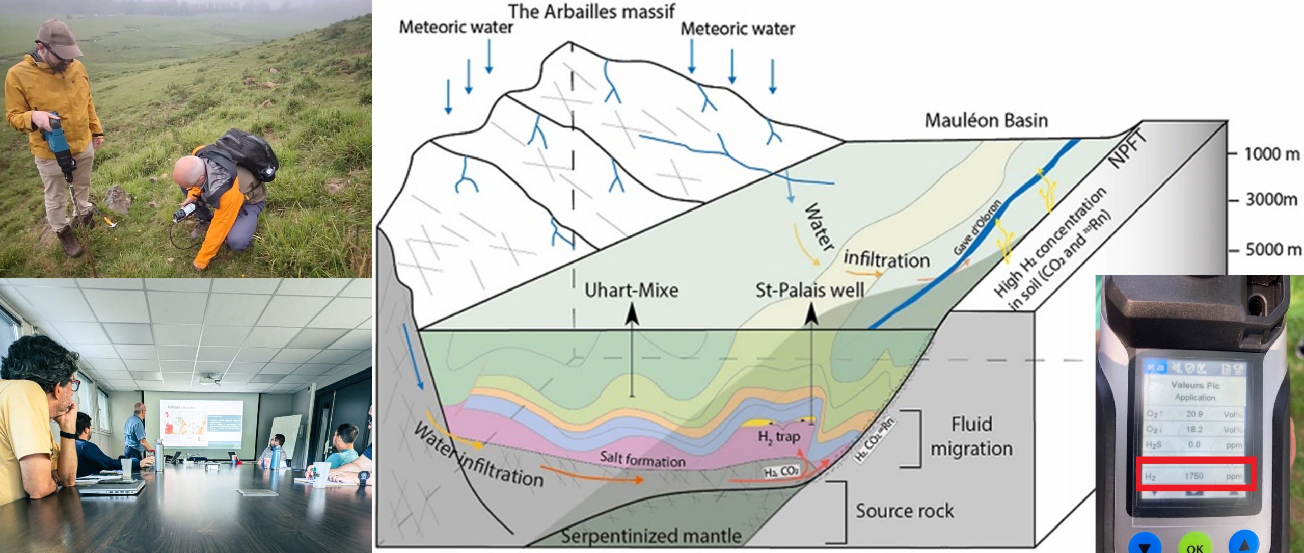
- Analyze ultramafic rocks that are targeted for CO2 mineralization studies and natural hydrogen exploration.
- Compare outcrop analogues to subsurface data for carbon sequestration in sedimentary rocks from several depositional environments.
- Characterize the locations of potential projects and explain the key geological factors that affect these and their feasibility.